

First Warning Forecast:
Freezing fog doesn't happen all the time around here, but when it does, it can be quite the impact. With temperatures dropping to near freezing (32 degrees) and below overnight, areas especially inland could be faced with it Wednesday morning. If you need a refresher, here is what it is and its biggest dangers:

We'll be jumping into a warming trend over the next few days with the warmest day being Thursday. Highs will be some 15 degrees above normal, which will feel like a major heat wave after the start to the week and what we had over the weekend.

We're tracking several precipitation chances to end the week and into next week. Basically, three separate weather systems that have their own separate components to figure out which type of precipitation we'll get. The first will be Friday, and at this point the precipitation will be all rain. That except for the tail end of the event which would be late Friday night into Saturday where we could see a *few* snowflakes. Models do not paint much in the way of snowfall accumulation for our area by Saturday morning, but it's still something to keep an eye on.

Next, is Sunday into Monday. This will be an area of low pressure, riding up the coast. Currently, the track keeps southern Virginia and northeastern North Carolina in the "warm sector" which translates to temperatures being too warm for an all-snow event. *If* we did see snow with this area of low pressure, it would be inland and closer to I-95.
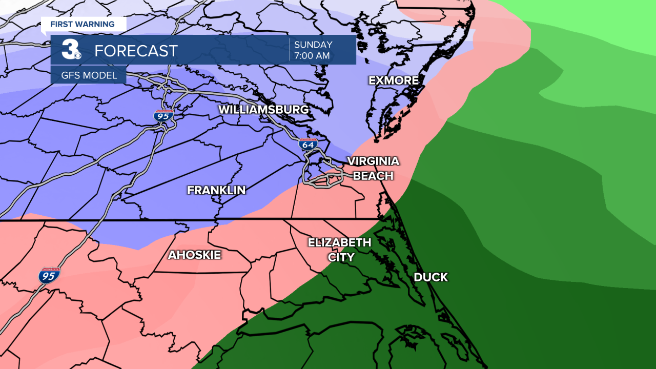
Lastly is a separate area of low pressure forming off the coast of Florida. Timing is almost a week out but would be Monday into Tuesday. Long range models disagree on the event in its entirety but the GFS in particular gives us a decent chance of accumulating snow. If said low pressure forms off the coast and stays far out to sea, this would be a non-event.

We'll keep an eye on all potential systems.
