


Meteorologist Myles Henderson’s First Warning Forecast
Much warmer air moving in for midweek. Tracking a cold front that will bring us rain Friday morning. Another cool down this weekend, behind the front.
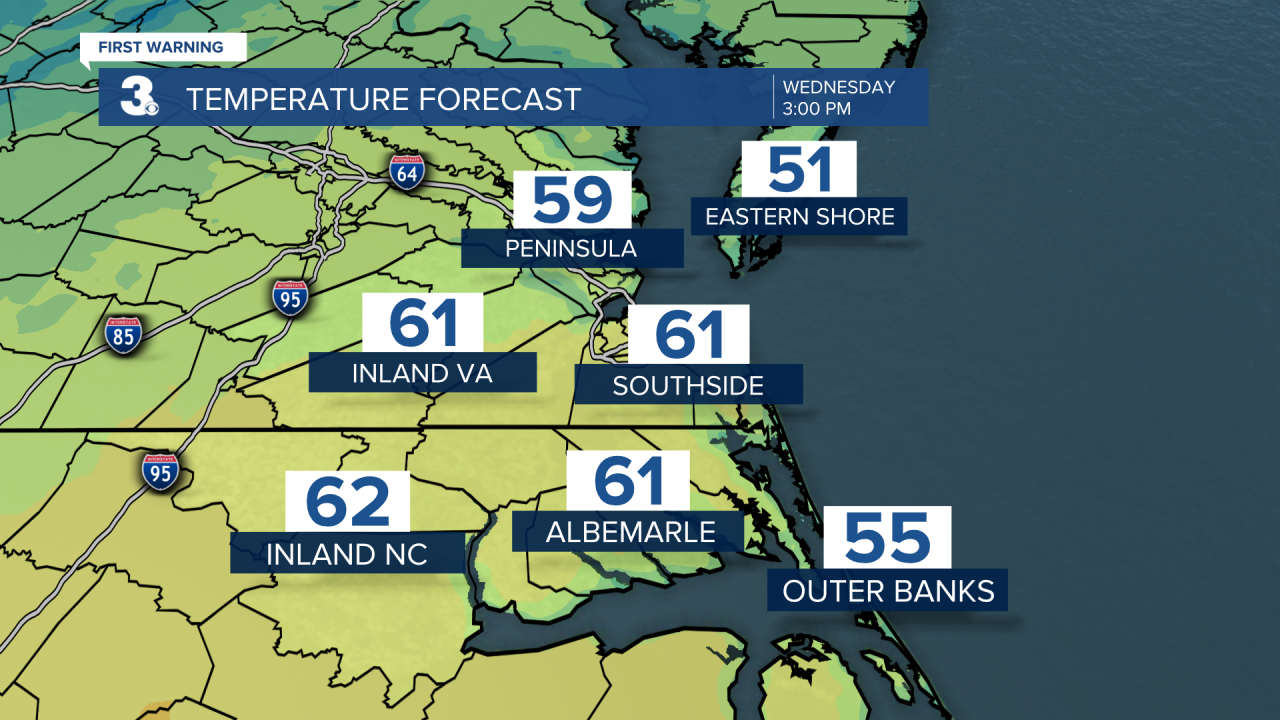
We will see mostly sunny to partly cloudy skies today. Temperatures will climb to near 60, about 20 degrees warmer than yesterday. Expect partly cloudy skies tonight with lows in the 40s.
Thursday will be the warmest day of the week with highs in the low 70s. Expect partly to mostly cloudy skies with a few spotty showers are possible. Winds will ramp up on Thursday, mainly south at 10 to 20 with gusts to near 30 mph.
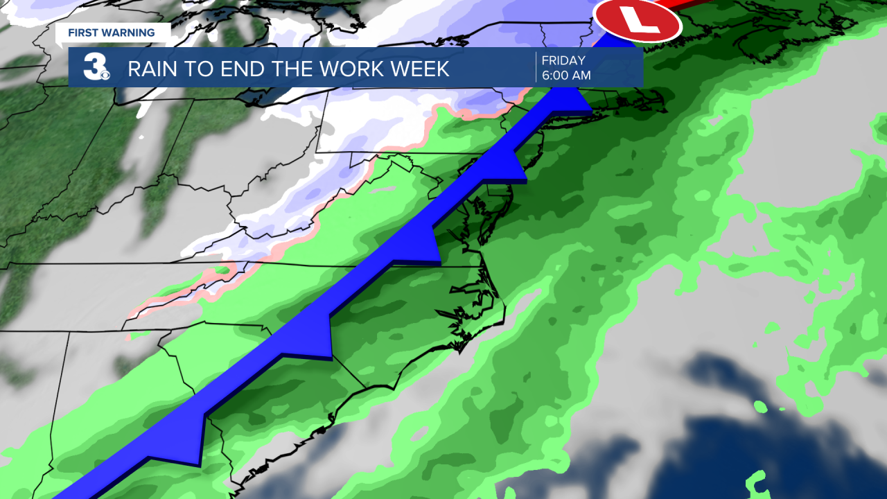
Friday will be the soggy day of the week. Expect rain and maybe even a rumble of thunder Friday morning as a cold front moves through. Rain will taper off around midday with clouds clearing out in the afternoon. Temperatures will start in the 60s Friday morning but fall to the 50s by the afternoon. It will still be windy, turning from SW to north at 15 to 25 with gusts to 30+ mph.
The weekend looks nice! Expect mostly sunny skies both days with highs in the low to mid 50s, near normal for this time of year.
Today: A Few Clouds. Highs in the low 60s. Winds: SE 5-15
Tonight: Mainly Clear. Lows in the low 30s. Winds: S 5-10
Tomorrow: Mix of Clouds, Breezy. Highs in the low 70s. Winds: S 10-20G0
Weather updates on social media:
Facebook: MylesHendersonWTKR
Twitter: @MHendersonWTKR
Instagram: @MylesHendersonWTKR
