First Warning Forecast:
It's finally spring! And we've got another great day on tap for Tuesday, take a look below.
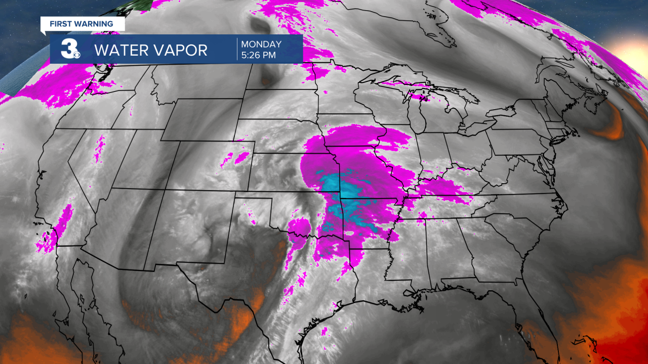
I'd take advantage of the tranquil weather, because we've got a strong spring storm system we're tracking set to move in midweek. Below is a visual of the "birth" of that system rolling off the Rockies interacting with the hefty Gulf of Mexico moisture. Water Vapor is a great way to see that moisture plume in action. Just look for the purple and blue.
And already, severe storms are happening late this Monday for parts of central Texas and western Louisiana. That same severe threat moves east Tuesday into parts of the Deep South including states like Mississippi and Alabama.


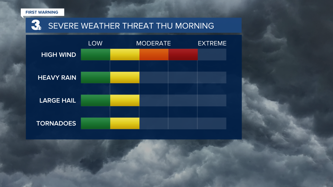
So should we be concerned? Yes. As it stands for northeastern North Carolina and mainly inland Virginia the severe weather would move in Wednesday night into early Thursday. Is it a done deal? No. Think interaction with the mountains and/or IF showers arrive early on Wednesday afternoon, along with lots of clouds, our severe threat could be diminished by the time the strongest energy moves in Thursday morning. Still a lot to watch over the next few days, including the storms strength, but here's a look at the severe threat over our area. The yellow is a level 2 storm threat.
(It's important to note that this outlook goes from 8AM Wednesday to 8AM Thursday).
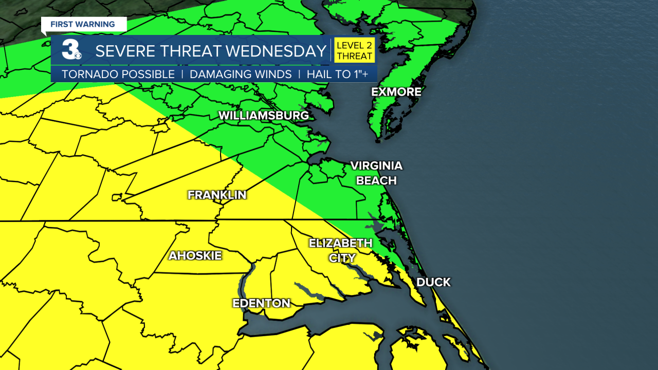
So what is our biggest severe threat? As it stands, damaging winds is our biggest threat however heavy rain, large hail and even a few tornadoes will be possible. Again, this is not a done deal but the timing is late Wednesday night into Thursday morning, so it's better to be prepared than caught off guard.