

Meteorologist Tony Nargi's First Warning Forecast
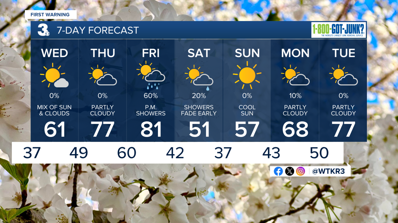
This evening temperatures will drop into the low 40s with winds dropping down to 5 to 10 mph. Overnight lows will drop into the 30s for most, with patchy frost possible for inland locations.

Tomorrow morning will start out with sun followed by a mix of sun and clouds during the afternoon. We'll be a step warmer on Wednesday, with high temperatures reaching the upper 50s to mid 60s. Winds will be lighter than today, with winds out of the SE at 5-10 mph. Overnight lows will not be quite as cold, with temperatures only dropping into the 40s and no frost expected.

Thursday will be a nice day, with partly cloudy skies and high temperatures in the mid 70s to nearly 80. Winds will be out of SW at 10-20 mph. Friday will start out mostly sunny with building clouds during the morning hours. It will be hot, with high temperatures in the 80s. By the afternoon, showers will arrive as a cold front push through the region. Winds will turn out of the N at 15-25 mph during the afternoon, with winds driven showers lasting through the evening.

This weekend looks pleasant and cooler , around 50 degrees. A stray shower is possible early Saturday morning followed by mostly sunny skies. Sunshine will stick around into Sunday, with slightly warmer temps expected.
Weather updates on social media:
