


Meteorologist Myles Henderson’s First Warning Forecast
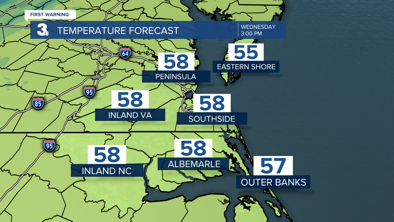
We will see lots of sunshine today with highs returning to the upper 50s. Temperatures will fall back to the 30s and 40s overnight.
We will see sunny skies again tomorrow with highs in the mid 60s. Sunshine will continue for the end of the work week as we gradually warm up. Highs will reach the upper 60s on Friday and the low 70s this weekend.

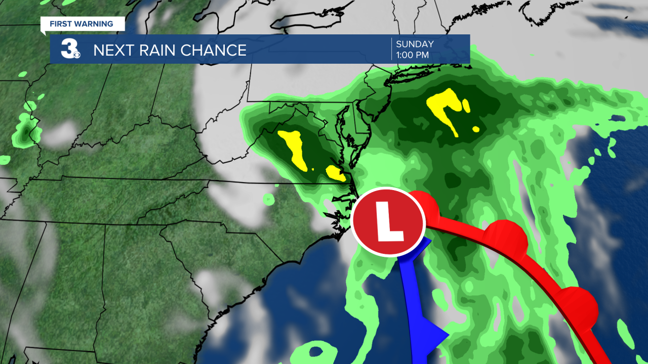
A weather system is expected to slide along the East Coast this weekend, potentially bringing us more clouds and a chance for rain. As of now, Saturday looks dry, and Sunday has the bigger rain chance.
Today: Mostly Sunny. Highs in the upper 50s. Winds: W 5-15
Tonight: Clear, Inland Frost. Lows near 40. Winds: W 5-10
Tomorrow: Mostly Sunny. Highs in the mid 60s. Winds: SW 5-10
Weather & Health
Pollen: Low (Ragweed, Grasses)
UV Index: 4 (Moderate)
Air Quality: Good (Code Green)
Mosquitoes: Moderate
Tropical Update
No tropical activity at this time
Weather updates on social media:
Facebook: MylesHendersonWTKR
Twitter: @MHendersonWTKR
Instagram: @MylesHendersonWTKR
