


Meteorologist Myles Henderson’s First Warning Forecast
A cold and breezy week with highs in the 30s. Look for a clearing trend to start the week.
Today’s highs will only warm to the mid and upper 30s, but it will feel colder with a NW wind at 10 to 20 mph. Expect mostly cloudy skies this morning with more sunshine by the afternoon. Temperatures will drop to the 20s and teens overnight.

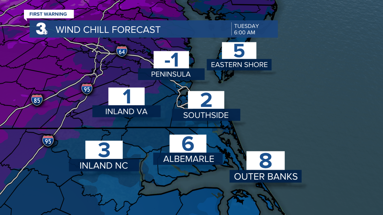
Get ready for a really cold start on Tuesday. Morning lows will drop to the teens with wind chill values in the single digits. Highs will only warm to the mid 30s but we will see lots of sunshine.
Still cold for the rest of the week. Highs in the low 30s and overnight lows in the upper teens Wednesday, Thursday, and Friday. An isolated snow shower is possible Wednesday night to Thursday morning but little to no accumulation is expected at this time.

We are watching another chance for wintry weather this weekend as an area of low-pressure slides up the East Coast. At this point in time, confidence is low. It is just something to keep an eye on as we go through the week.
Today: Some Clearing. Highs in the upper 30s. Winds: NW 10-20
Tonight: Clearing Skies. Lows in the mid teens. Winds: NW 10-20
Tomorrow: Mostly Sunny. Highs in the mid 30s. Winds: SW 5-15
Weather updates on social media:
Facebook: MylesHendersonWTKR
Instagram: @MylesHendersonWTKR
