


Meteorologist Myles Henderson’s First Warning Forecast
Soggy, cloudy, and cool today with more rain on the way later this week. Another dramatic temperature swing this weekend.
Today will be a gloomy and soggy day as a stationary front and area of low pressure linger along the Carolina coast. Expect overcast skies with widespread rain this morning. Rain will become more scattered by midday and this afternoon. Highs will return to near 50 degrees.
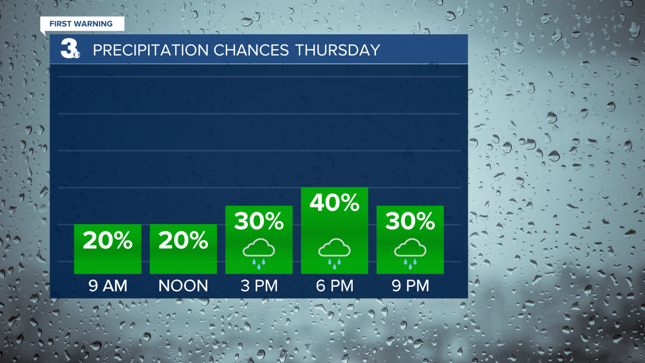
Clouds and scattered showers will linger for Thursday. Expect mostly cloudy skies with showers most likely in the afternoon to evening. Temperatures will struggle to break 50 tomorrow.
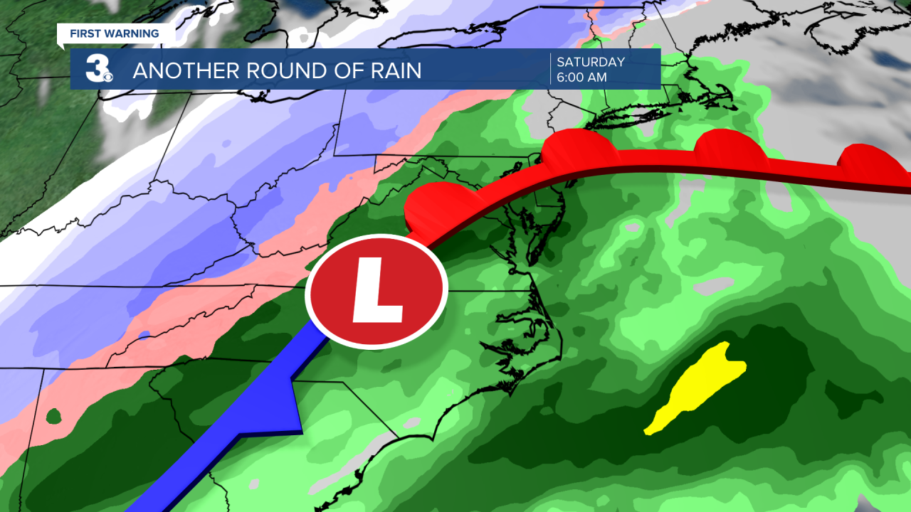
Most of the day Friday will be nice with partly cloudy skies and highs warming to the upper 50s. We are tracking a cold front that will bring us another round of rain Friday night to Saturday morning. Temperatures will drop from near 60 on Saturday to the upper 40s on Sunday behind the cold front.
Today: Cloudy, Rain, Breezy. Highs in the low 50s. Winds: NE/N 5-15
Tonight: Mostly Cloudy, Showers. Lows in the low 40s. Winds: N 5-15
Tomorrow: Mostly Cloudy, Showers. Highs in the upper 40s. Winds: NE 5-15
Weather & Health
Pollen: Low (Juniper, Maple, Ash)
UV Index: 2 (Low)
Air Quality: Good (Code Green
Mosquitoes: Low-Moderate
Weather updates on social media:
Facebook: MylesHendersonWTKR
Twitter: @MHendersonWTKR
Instagram: @MylesHendersonWTKR
