


Meteorologist Myles Henderson’s First Warning Forecast
A warming trend through midweek. Tracking rain, snow, and ice for the weekend. A very cold stretch to start next week.
Today will be the warmest day of the week with highs in the upper 50s, about 10 degrees warmer than yesterday. Expect a nice mix of sun and clouds with a stray shower possible.

Highs will drop back to the upper 40s on Friday with partly to mostly cloudy skies and an isolated shower possible.
Colder air and messy weather is set to move in this weekend as an area of low pressure slides across the Southeast to the Mid-Atlantic. A mix of snow, rain, and ice is possible for much of VA and NC Saturday and Sunday.
Watch related coverage: Gov. Abigail Spanberger declares state of emergency ahead of winter weather's arrival
Snow showers will build in Saturday night for most of the area with a wintry mix in NE NC. As temperatures rise on Sunday, we will see a mix of precipitation from snow to sleet to freezing rain to rain. Most of the region will change over to rain by Sunday afternoon. As temperatures drop Sunday night we could return to a wintry mix. The mix of precipitation should clear out Monday morning.
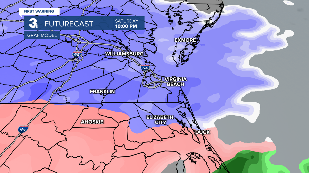
Most of our snow accumulation is expected Saturday night. Some ice accumulation is likely Sunday to Monday morning with the mix of precipitation. Snow and ice accumulation can result in downed trees and power outages, plan accordingly.
Get ready for a cold stretch of days. Highs will only climb to near 30 on Saturday, but we will warm to near 40 on Sunday. Highs will drop back to the mid 30s to start next week with morning lows in the teens and 20s.

Today: Partly Cloudy. Highs in the upper 50s. Winds: W 5-10
Tonight: Partly Cloudy. Lows in the mid 30s. Winds: W 5-10
Tomorrow: Partly Cloudy. Highs in the upper 40s. Winds: N 5-10
Weather updates on social media:
Facebook: MylesHendersonWTKR
Instagram: @MylesHendersonWTKR
