

Meteorologist Tony Nargi's First Warning Forecast
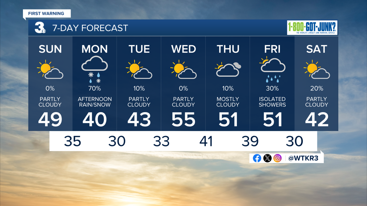
Today will start off with fog, with freezing fog possible inland. Some slick spots will be possible, take caution when heading out this morning! Fog will dissipate by 10 am, with partly cloudy skies expected today. High temperatures will be near 50, with very light winds out of the NE at 4-8 mph. Overnight clouds will increase with mostly cloudy skies expected. Winds will pick up out of the NE at 5-15 mph, with low temperatures reaching the mid 30s.

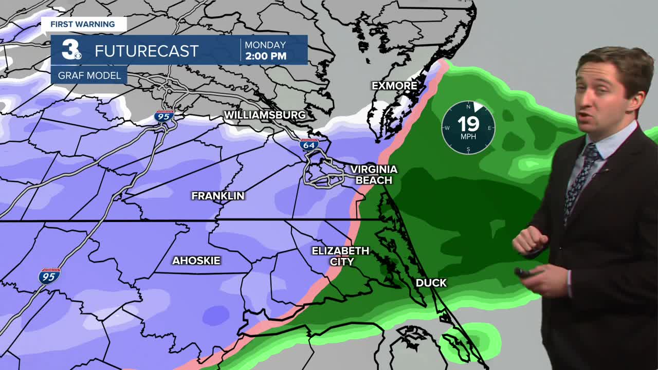
Tomorrow we're tracking another chance for some wet snow. Monday will start off cloudy with temperatures in the upper 30s and low 40s. Temperatures will drop into the low to mid 30s during the afternoon. Rain and wet snow showers will overspread the region around noon, with rain/mix turning to all wet snow around 5 pm. Snowfall amounts will be limited due to above freezing temperatures, with inland Virginia seeing up to an inch of snow. Hampton Roads will see some slushy coatings on grassy surfaces and cars, but road conditions will be mainly wet. Monday will also be windy, with winds out of the NE at 15-25 mph gusting up to 35 mph. Skies will start to clear Monday night as temperatures drop into the 20s and low 30s. Tuesday will be partly cloudy and cool, with high temperatures in the low 40s.


Wednesday and Thursday of this week will be dry and a step warmer, with highs in the mid 50s. Another chance of rain arrives on Friday, with a cool weekend following the chance of showers.
Weather updates on social media:
