


Meteorologist Myles Henderson’s First Warning Forecast
*** Dense Fog Advisory until 10 AM for Virginia Beach, Norfolk, Portsmouth, Chesapeake, Suffolk, Isle of Wight, Hampton, Newport News, Poquoson, York, Williamsburg, James City, Gloucester, Mathews, Middlesex, Northampton, Accomack, Dare, Currituck, Camden, Pasquotank, Perquimans, Chowan, Gates.

Another gloomy morning. Cooler and windy to end the week. Tracking rain chances for the weekend and Halloween.
Watch out for areas of dense fog this morning. We will see mostly cloudy to partly cloudy skies today with more clouds in the morning and a better chance for some sunshine in the afternoon. A stray shower or drizzle is possible. Highs will warm to the mid 70s today. A cold front will move through overnight. Rain chances will be limited but colder air will follow.
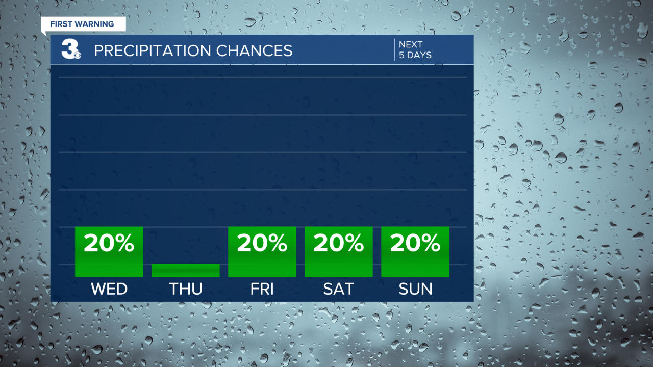
We will see more sunshine on Thursday, but it will be cooler with highs in the mid 60s. Winds will also start to pick up, north at 10 to 20 mph. Highs will remain in the low to mid 60s for Friday and the weekend. Persistent NE winds will continue with mostly cloudy skies and spotty showers as an area of low pressure lingers off the East Coast.
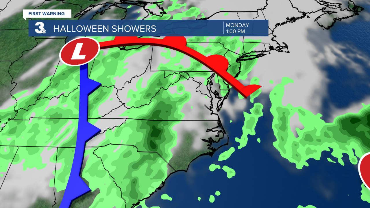
Rain chances will go up for Monday (Halloween) as a cold front moves in from the southwest.
Today: Mix of Clouds, Spotty Showers. Highs in the mid 70s. Winds: SW 5-10
Tonight: Partly Cloudy, Spotty Showers. Lows in the upper 50s. Winds: SW 5-10
Tomorrow: Partly Cloudy, Breezy. Highs in the mid 60s. Winds: N 10-20
Weather & Health
Pollen: Low (Ragweed, Grasses)
UV Index: 4 (Moderate)
Air Quality: Good (Code Green)
Mosquitoes: High
Tropical Update
A trough of low pressure stretching from the central Caribbean to the southwestern Atlantic continues to produce a broad area of disorganized showers and thunderstorms. Environmental conditions appear conducive for some gradual subtropical development of this system over the next few days while it drifts NNE. The system is then forecast to meander over the subtropical western Atlantic to the west or southwest of Bermuda. Upper-level winds are forecast to become less conducive for development by the end of the weekend.
* Formation chance through 48 hours: Low (10%)
* Formation chance through 5 days: Low (30%)
An area of low pressure could form over the eastern Caribbean Sea by early this weekend. Environmental conditions are forecast to be conducive for gradual development as the low moves generally west or WNW into the central Caribbean by the end of the weekend.
* Formation chance through 48 hours: Low (0%)
* Formation chance through 5 days: Low (20%)

Weather updates on social media:
Facebook: MylesHendersonWTKR
Twitter: @MHendersonWTKR
Instagram: @MylesHendersonWTKR
