Meteorologist Maddie Kirker's First Warning Forecast:
Another hot day and a cold front on the way… Expect another warm and muggy morning with temperatures in the 70s.

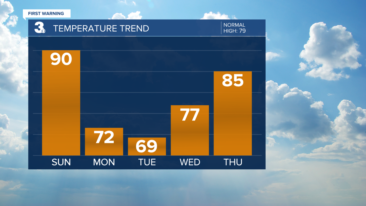
It'll be less hot this afternoon (but still steamy) with highs near 90, still nearly 15 degrees above normal for this time of year. Skies will feature a mix of sun and clouds and a pop-up storm this afternoon cannot be ruled out. Storm chances increase early this evening as a cold front begins to move in across the area. Expect scattered showers and storms to move in from west to east this evening and overnight.
Some storms could be strong with gusty winds, hail, and locally heavy downpours but the greatest threat of severe weather should stay well north of the area.
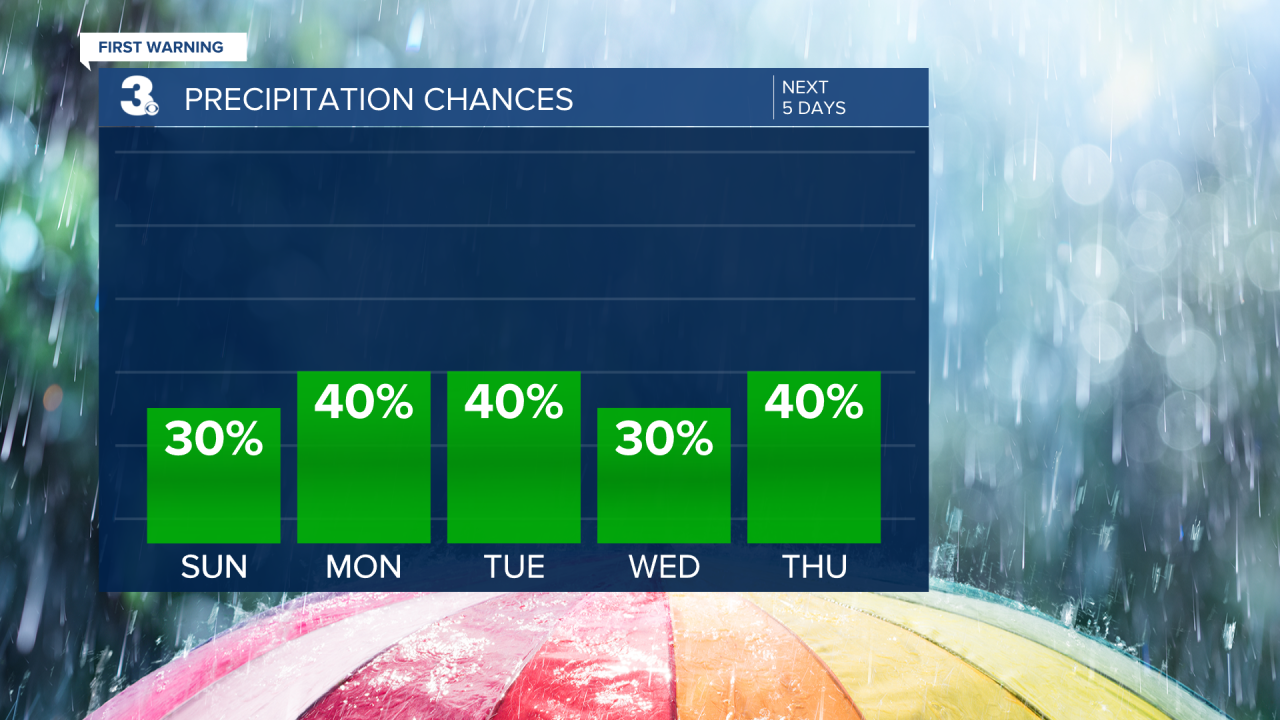
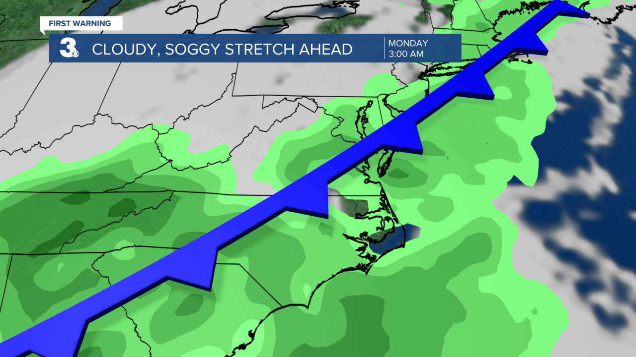
Tonight's cold front will stall across the area and off the coast Monday through Wednesday. This will lead to a gloomy start to the work week with off and on showers beginning Monday under mainly cloudy skies. It'll be noticeably cooler as well. Highs will be in the low to mid 70s Monday and fall to the upper 60s to low 70s Tuesday. It'll be gloomy through midweek before we see a little more sunshine and warmer highs in the 80s Thursday and Friday.