


Meteorologist Myles Henderson’s First Warning Forecast
Several days in the 70s to end the week. Tracking showers to end the weekend.
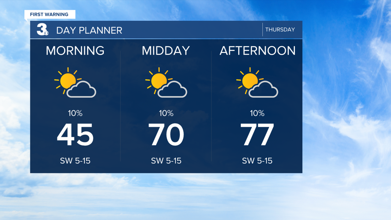
Watch out for a few areas of fog this morning. We will see a nice mix of sun and clouds today. Temperatures will warm to the mid and upper 70s today, about 20 degrees above normal for this time of year.
The warm stretch continues to end the work week. Highs will reach the low 70s on Friday with cooler air pushing in near the Chesapeake Bay and warmer air to the south and west. Expect mostly sunny to partly cloudy skies with slim rain chances.
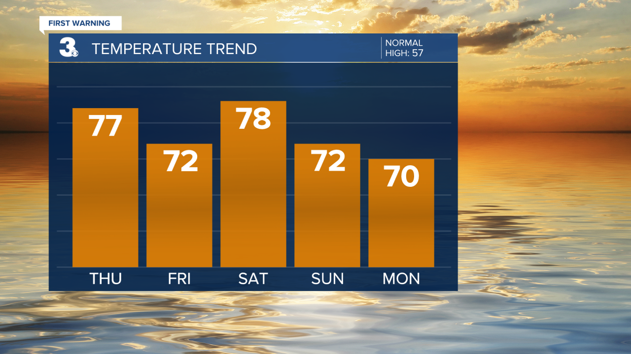
Highs will linger in the 70s this weekend, upper 70s Saturday and low 70s Sunday. We are tracking a cold front that will bring in showers on Sunday into early next week.

Today: Sun & Clouds. Highs in the upper 70s. Winds: SW 5-15
Tonight: Partly Cloudy. Lows in the mid 50s. Winds: SW 5-10
Tomorrow: Sun & Clouds. Highs in the low 70s. Winds: W/N/E 5-10
Weather & Health
Pollen: Medium-High (Juniper, Elm, Maple)
UV Index: 5 (Moderate)
Air Quality: Moderate (Code Yellow)
Mosquitoes: Low
Weather updates on social media:
Facebook: MylesHendersonWTKR
Instagram: @MylesHendersonWTKR
