


Meteorologist Myles Henderson’s First Warning Forecast
Feeling more like summer with highs in the 90s. Tracking showers and storms for Thursday and Friday. Cooler and less humid this weekend.
Highs will return to the low and mid 90s this afternoon, 10 to 15 degrees above normal for this time of year. Expect mostly sunny to partly cloudy skies with a stray shower/storm possible this afternoon to evening.
More rain and storms will move in with a cold front for Thursday and Friday. Scattered showers and storms are expected Thursday evening to night. Strong to severe thunderstorms are possible with a higher risk to the north and lower risk to the south. Scattered showers will linger for Friday. Temperatures will also drop behind the front, from the mid 90s on Thursday to the low 80s on Friday.

It will feel a bit more like spring this weekend. Highs will dip to the upper 70s and low 80s with lower humidity. We will see partly cloudy skies with slim rain chances.
Today: Sun & Clouds, Spotty Showers. Highs in the mid 90s. Winds: W/N/E 5-10
Tonight: A Few Clouds. Lows in the low 70s. Winds: S 5-10
Tomorrow: Sun & Clouds, Evening Storms. Highs in the mid 90s. Winds: SW 5-10
Weather & Health
Pollen: Medium (Grasses, Oak, Hickory)
UV Index: 9 (Very High)
Air Quality: Moderate (Code Yellow)
Mosquitoes: Extreme
Tropical Update
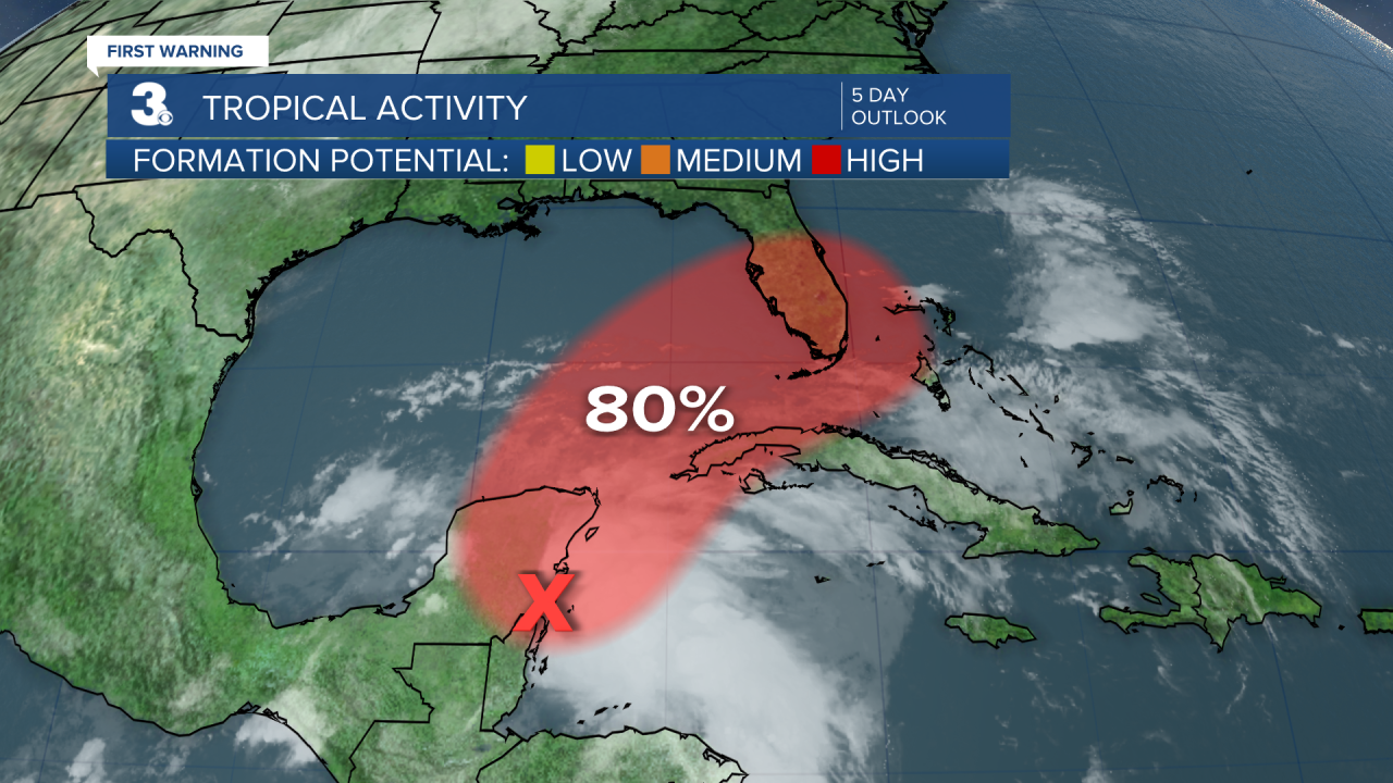
A large area of disorganized showers and thunderstorms located over the northwestern Caribbean Sea and Yucatan Peninsula is associated with a broad area of low pressure. Environmental conditions appear conducive for gradual development, and this system is likely to become a tropical depression while it moves northeast over the northwestern Caribbean Sea and southeastern Gulf of Mexico during the next couple of days.
* Formation chance through 48 hours: High (70%)
* Formation chance through 5 days: High (80%)
Weather updates on social media:
Facebook: MylesHendersonWTKR
Twitter: @MHendersonWTKR
Instagram: @MylesHendersonWTKR
