


First Warning Forecast:
Skies will be clear as temperatures plummet to the low to mid 20s by Tuesday morning. Thanks to a blustery north wind between 10 and 20+ mph, wind chills will be as cold as the teens and single digits.

Tuesday will be the coldest day of the week. We will see lots of sunshine tomorrow, but temperatures will struggle to break the freezing point. Expect wind chill values in the 20s by the afternoon.
Sunshine will continue for Wednesday, and we will warm to the mid 40s, still about 5 degrees below normal for this time of year.
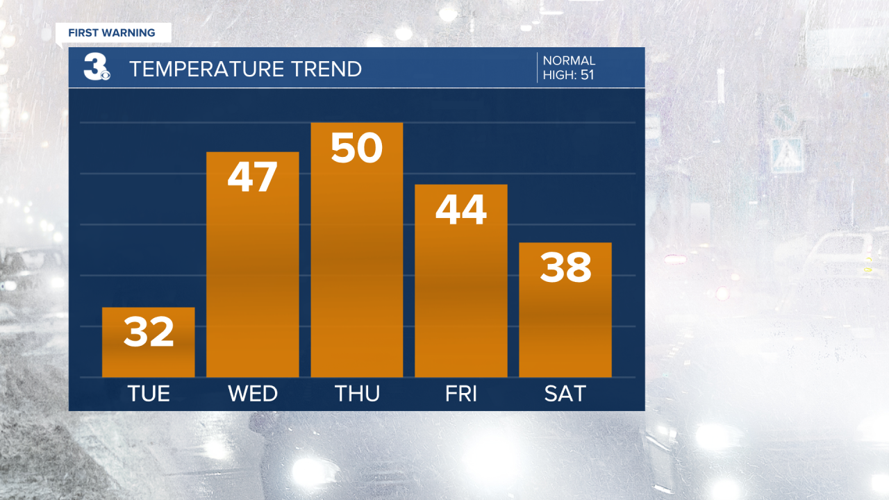
More clouds will mix in for Thursday with a spotty shower possible. Highs will reach the upper 40s. Expect partly cloudy skies and mid 40s on Friday.

The major forecast models are pointing toward a good chance for snow this weekend. A lot could change between now and then, but we're looking at possible snow by late Saturday afternoon, Saturday night and early Sunday.
