


Meteorologist Myles Henderson’s First Warning Forecast
Midweek scattered showers. Sunshine and chilly to end the work week. Another temperature swing this weekend.
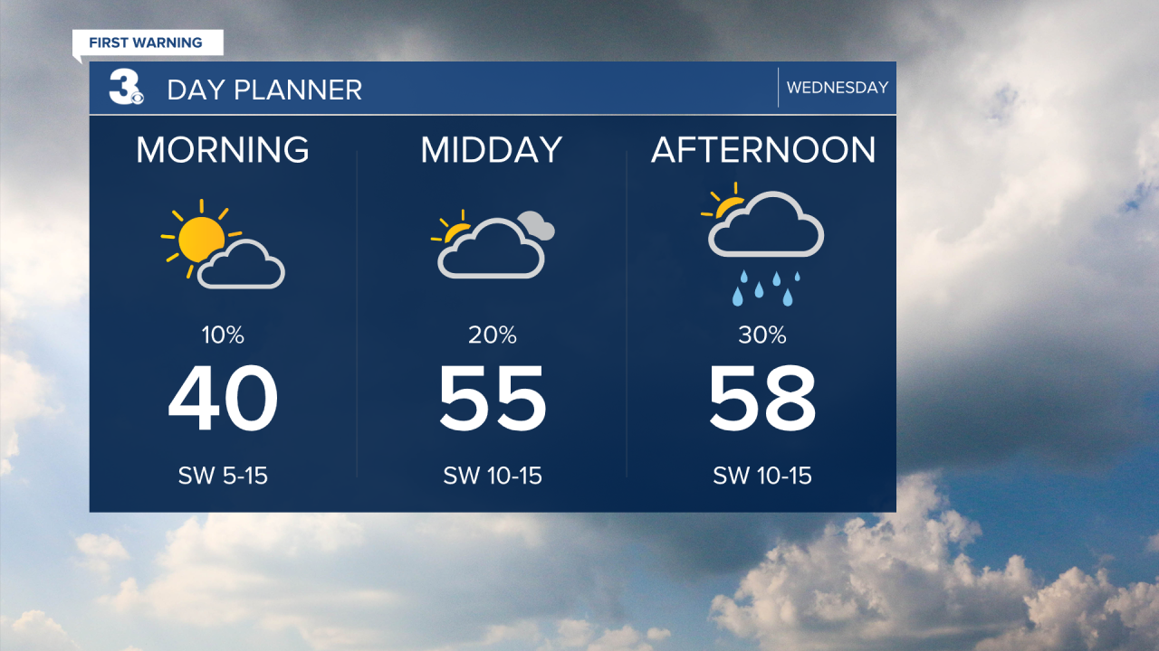
Look for building clouds today (partly to mostly cloudy skies) with scattered rain showers. Highs will return to the upper 50s with a SW wind picking up.
Rain/snow showers are possible early Thursday morning, but little to no snow accumulation is expected. It will be chilly and windy on Thursday with temperatures falling into the 30s and winds gusting 20 to 30 mph.
Expect sunshine on Friday, but still chilly with highs in the low 40s.
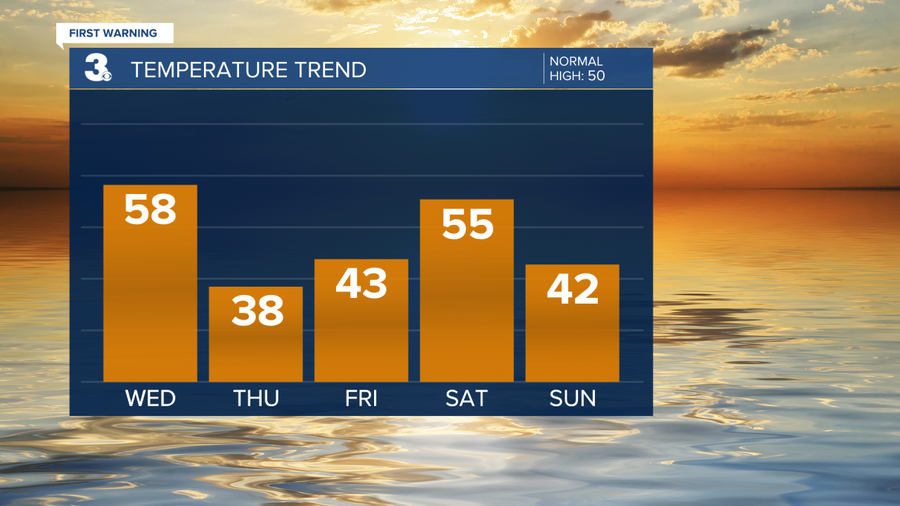
Get ready for another temperature swing this weekend. Highs will warm to the mid 50s on Saturday, then drop to the mid 40s on Sunday. Expect partly cloudy skies with spotty showers possible both days.
Today: Building Clouds, Scattered Showers. Highs upper 50s. Winds: SW 10-15
Tonight: Mostly Cloudy, Scattered Showers. Temperatures in the 40s. Winds: W 5-15
Tomorrow: Clearing Skies, Windy. Temperatures in the upper 30s. Winds: NW 10-20G30
Weather updates on social media:
Facebook: MylesHendersonWTKR
Instagram: @MylesHendersonWTKR
