Meteorologist Maddie Kirker's First Warning Forecast:
It's another gloomy morning with low clouds, drizzle and areas of fog.

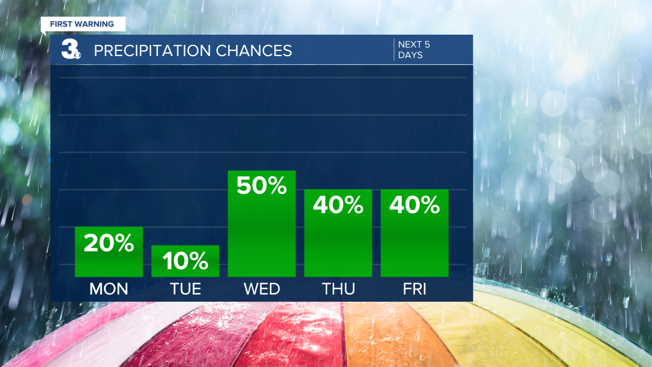
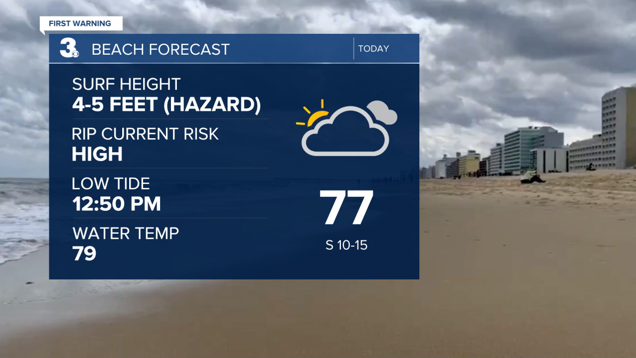
Temperatures are in the upper 60s and low 70s. Sunshine will break out first across the northwest through midday and last across the southeast this afternoon, but regardless we'll have to keep a chance of a stray shower in the forecast, especially across North Carolina (20%). Also - despite us being in traditionally the hottest stretch of the year, highs will only reach the low 80s today, nearly 10 degrees below normal. Be careful at the beach today - a Beach Hazard Statement has been issued for Virginia Beach as waves will be choppy and the Rip Current Risk is High today.
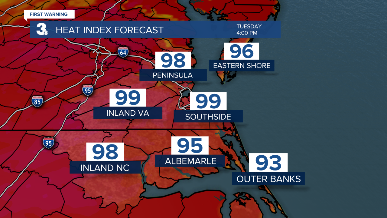
Get ready for a major warmup Tuesday. Highs will soar to the low to mid 90s with heat index values near 100. With mainly sunny skies, Tuesday will be the driest day of the week.
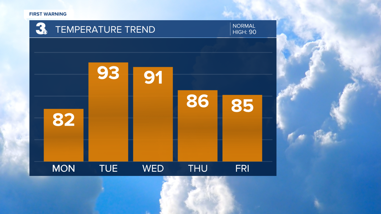
Our severe threat increases again as we head into Wednesday. A cold front will approach the area leading to scattered showers and storms during the afternoon and evening. Most of the area is under a Level 1 Threat for severe weather. Highs will be hot and in the low 90s.


This front will actually stall across the area for the rest of the week leading to continued rain and storm chances through Friday. Highs will back down a bit Thursday and Friday, to the mid 80s.