


Meteorologist Myles Henderson’s First Warning Forecast
Clearing, cold, and windy as the coastal storm starts to move away from the Carolina coast.
Snow showers will move out this morning, and clouds will start to clear out this afternoon. It will still be very cold and windy. Temperatures will only reach the mid 20s today with a wind chill in the teens. Wind will gust to 40+ this morning and gusts to 30+ this afternoon, continuing to slowly back down tonight.

Watch out for flooding near times of high tide this morning (9 AM). We could also see areas of ocean overwash on the Outer Banks.
Lots of sunshine on Monday and a step warmer. Highs will climb to the mid 30s tomorrow, finally above freezing. Our overnight lows will still be below freezing so refreeze is possible.
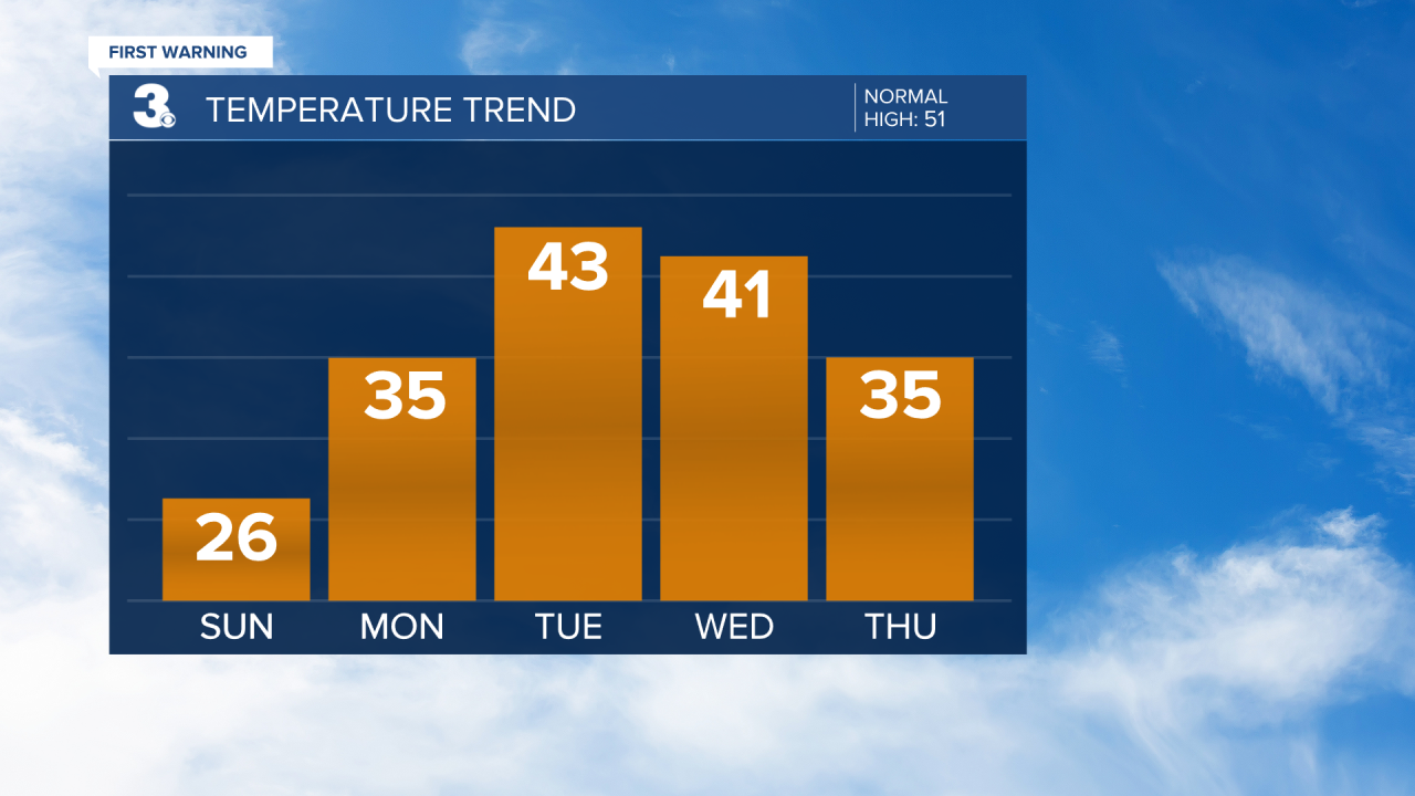
Highs will warm to the 40s on Tuesday with building clouds. We are watching a rain/snow chance on Wednesday, but overall moisture seems to be limited.
Today: AM Snow, Windy. Highs in the mid 20s. Winds: N/NW 20-30 G40
Tonight: Mainly Clear. Lows in the upper teens. Winds: NW 10-20
Tomorrow: Mostly Sunny. Highs in the mid 30s. Winds: NW 5-15
Weather updates on social media:
Facebook: MylesHendersonWTKR
Instagram: @MylesHendersonWTKR
