

Meteorologist Tony Nargi's First Warning Forecast
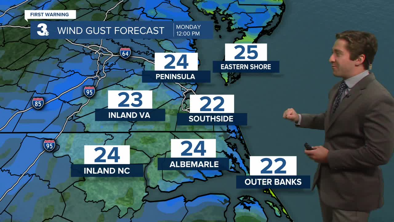
Today will be mostly sunny after last nights showers clear out. It will be a nice fall day, with near normal temperatures in the upper 60s and winds out of the W at 10-15 mph. Overnight will be cool with temperatures dropping into the 40s for many. Waters will stay rough today, with 5-8 foot waves on the Atlantic and 2-4 foot waves on the Chesapeake. A small craft advisory is in effect.


A calm and pleasant stretch of weather is expected to continue over the next week or so, with mostly sunny skies expected Tuesday with highs near normal in the low 70s. Winds will be noticeable out of the S at 10-20 mph. Wednesday will start out with temperatures in the 50s with high temperatures expected to reach the upper 60s to low 70s. On Tuesday night/Wednesday morning a cold front will move through, but no/little precipitation is expected.

Highs will dip into the 60s to end the week after the cold front passage. Sunshine is expected through Friday, with our next chance of rain not expected until Sunday.

TRACKING THE TROPICS
A tropical wave in the Caribbean has a good chance of developing into a tropical cyclone later this week. We'll keep you updated on its track, right now it poses no threat to the United States.

Highs will dip into the 60s to end the week after the cold front passage. Sunshine is expected through Friday, with our next chance of rain not expected until Sunday.
Weather updates on social media:
