



Meteorologist Tony Nargi's First Warning Forecast
Today will be warm and pleasant, with mostly sunny skies expected along with light winds out of the SE at 5-10 mph. High temperatures will reach the mid to upper 80s, with dew points in the mid to upper 60s. Mainly dry conditions are expected, with just a 10% chance of rain. Overnight clouds will develop, with isolated showers possible for the Eastern Shore and Peninsulas. Lows will drop into the upper 60s and low 70s.

Tomorrow will feature dry conditions in the morning followed by increasing clouds during the afternoon. Scattered storms are possible, with a 40% chance of an afternoon storm. High temperatures will vary across the region, with low 80s north, mid 80s across Southside, and upper 80s in North Carolina. Winds will be out of the E at 5-15 mph.

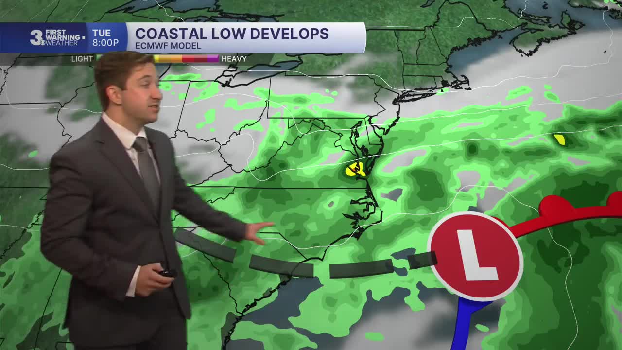
A coastal low will begin to develop offshore on Tuesday, bringing widespread rain, windy conditions, and tidal flooding as well. Winds will be out of the NE at 15-25 mph, gusting up to 35 mph at times by the evening. High temperatures will reach the mid to upper 70s. Rain and windy conditions will continue into Wednesday, with strong northeast winds at 20-30 mph expected, with gusts up to 35 mph. We'll see 1-3" of rain over the course of the two days, with localized flash flooding possible as well. Tidal flooding is likely across multiple tide cycles Tuesday through Thursday.


Showers will start to fade Thursday afternoon, with drier conditions emerging Friday and Saturday. Breezy conditions will likely last through Friday, possibly lingering into Saturday as well.

TROPICS:

Tropical Storm Fay has formed in the Central Atlantic. It is not expected to strengthen into a hurricane and is not expected to impact land.
The coastal low expected to develop this week may develop some tropical characteristics late in the week once it sheds its fronts. It may organize around a warm core and could be classified as a subtropical storm by Friday or Saturday but is unlikely to be classified as a tropical storm.
Weather updates on social media:
