

Meteorologist Tony Nargi's First Warning Forecast
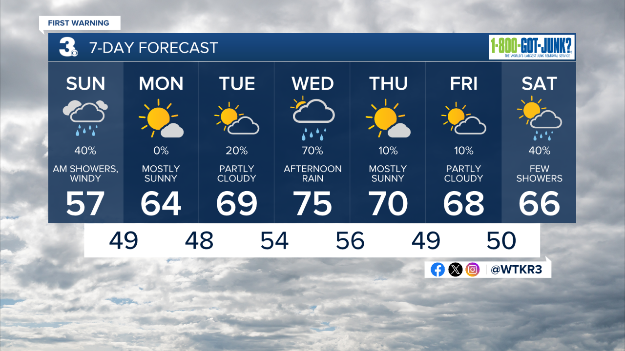
Today will start off with a few showers and cloudy skies. A cooler pattern is settling into the region for the next week or two. Temperatures will remain steady in the mid to upper 50s for most of the day. Showers clear out by the afternoon, but clouds will linger until tonight. Winds will pick up during the afternoon, out of the NE at 10-20 mph with gusts up to 35 mph possible. Tonight temperatures will drop into the 40s with clearing skies and breezy conditions staying in place.

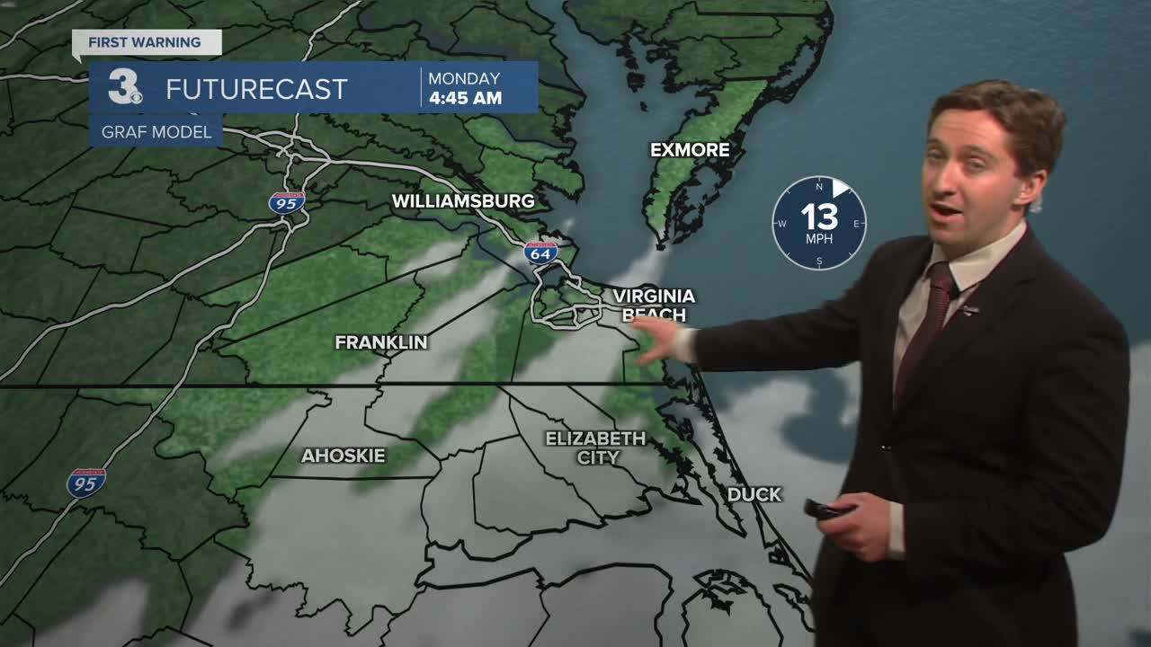
Tomorrow will start off with a few clouds followed by clear skies and cool conditions. High temperatures will reach the mid 60s with a noticeable breeze out of the NE at 10-15 mph. Overnight skies will be clear with lows dropping into 40s.

Tuesday will be mostly sunny to start with some clouds moving in during the afternoon. High temperatures will reach the upper 60s to low 70s. There is a 20% chance of a stray shower during the afternoon or evening, though most will stay dry. On Wednesday we'll have a better chance for some rain, with mostly cloudy skies in the morning turning to widespread showers during the afternoon. High temperatures will reach the mid 70s.

Dry conditions are expected Thursday and Friday with highs near 70. Another round of rain is possible on Saturday.
Weather updates on social media:
