

Derrah Getter's First Warning Forecast
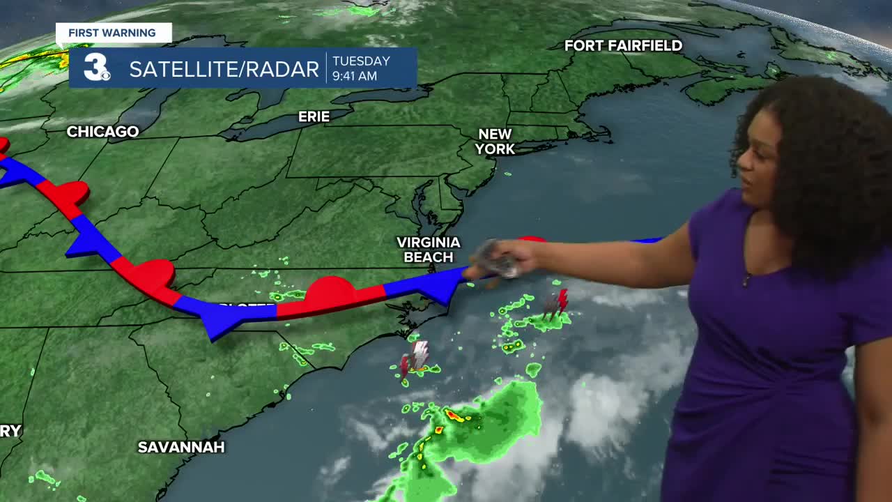
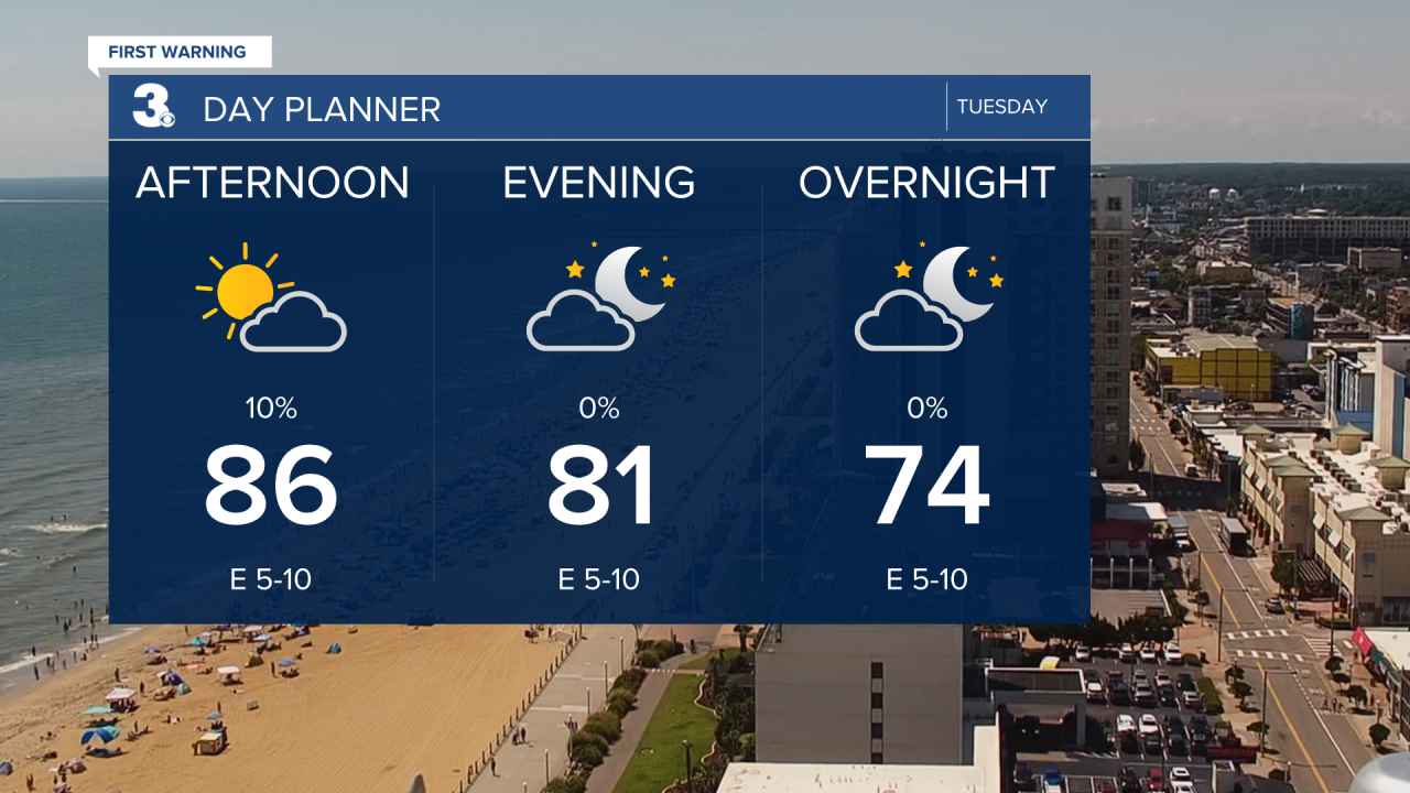
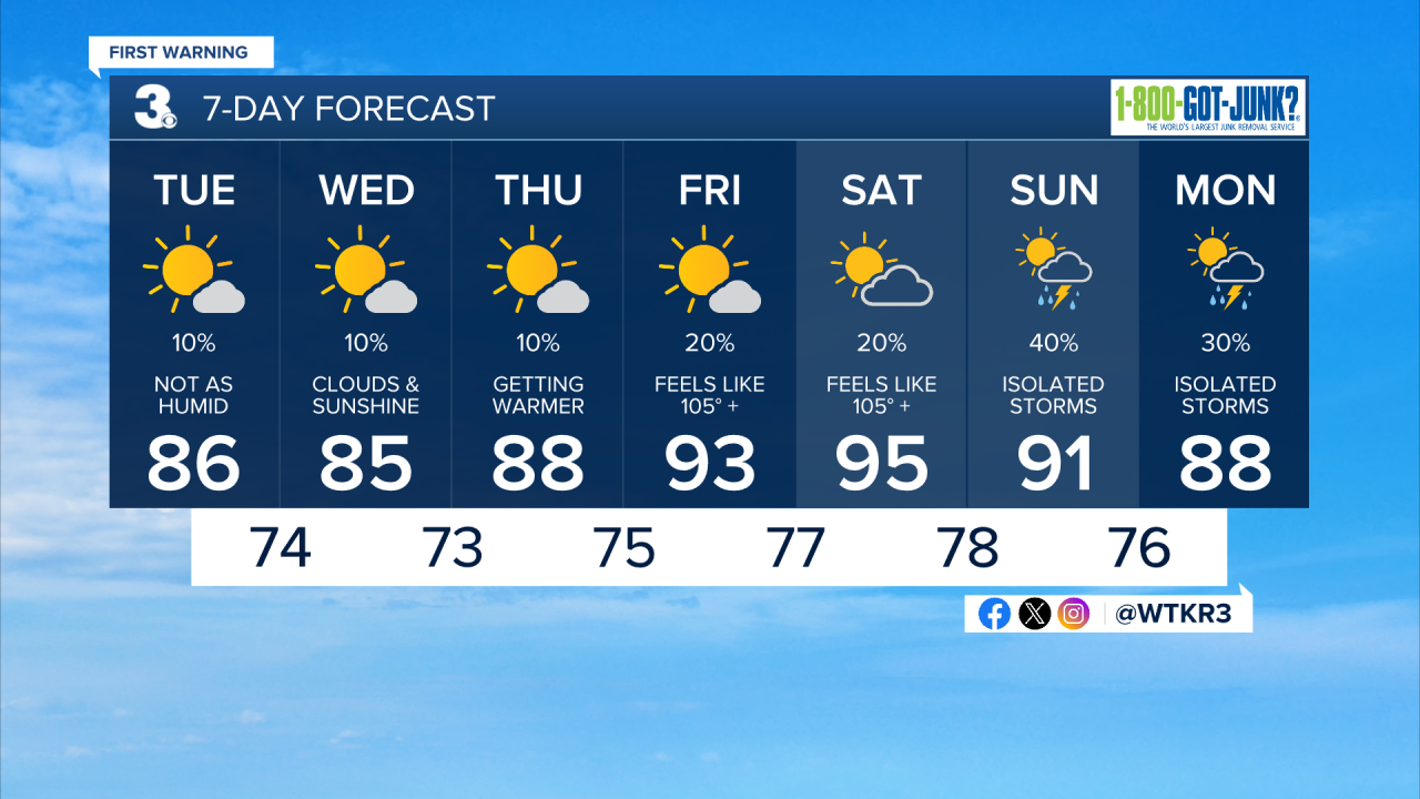
This afternoon will be mild and comfortable with noticeably lower humidity and a light breeze. Highs today reach the mid 80s. There will be plenty of sunshine but a few isolated showers and storms will be possible mainly along the Outer Banks.
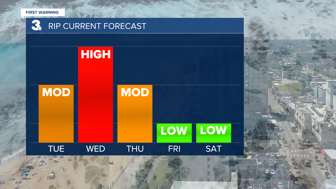
There is a moderate risk for rip currents Tuesday and a high rip risk Wednesday. The highest time to see rip currents is at low tide. Swim close to the lifeguard stands.
The comfortable conditions extend through the middle of the work week with highs in the mid 80s and lower humidity. Rain chances will be lower as well.
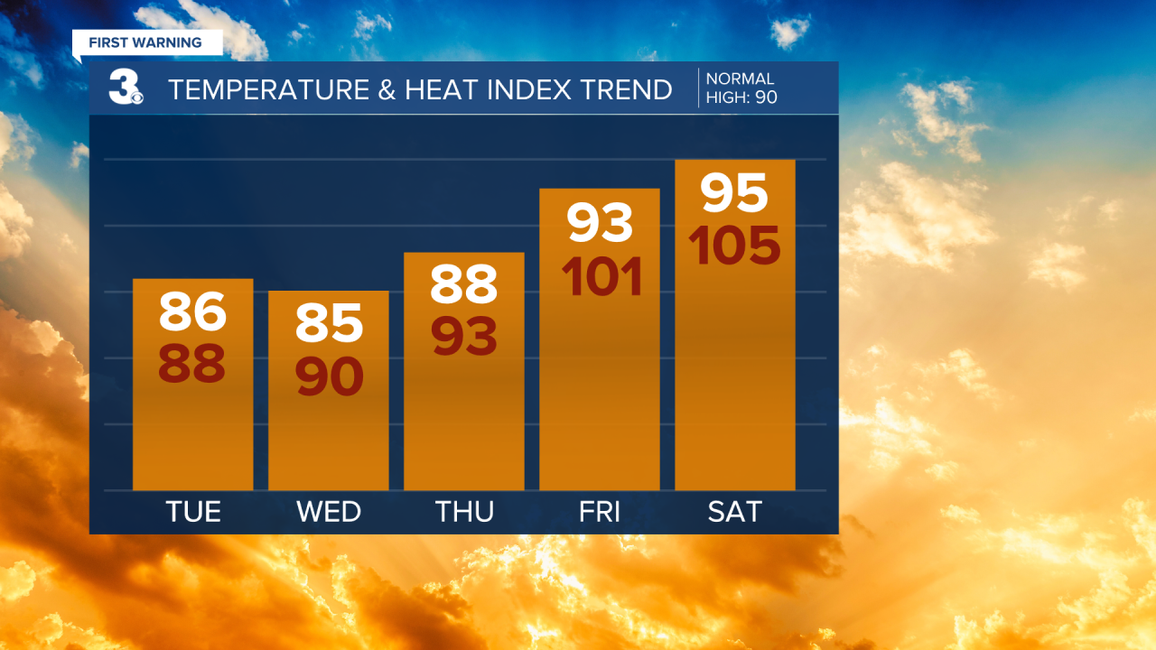
The heat builds back in just before the upcoming weekend. Highs climb back to the 90s and heat index values will reach the low triple digits. Isolated storm chances return early next week.
Let's connect on social media!
Forecaster Derrah Getter:
For weather updates on Facebook: HERE
For weather updates on X: HERE
Follow me on Instagram: HERE
Check out the Interactive Radar on WTKR.com: Interactive Radar
