

Meteorologist Tony Nargi's First Warning Forecast
After a cool start in the 60s and even 50s for some this morning, temperatures rebound into the low to mid 80s this afternoon. We'll see sunny skies to start our Saturday, followed by increasing clouds during the afternoon and overcast skies by the evening. Winds will be light out of the E at 5-10 mph. Rip current risk will be high once again today, with surf of 3 to 4 feet. Some nuisance tidal flooding will be possible as well, but flooding is expected to be less than what we saw on Friday and Thursday. A coastal flood Advisory is still in effect today for the Middle Peninsula and Accomack County and Dare County.

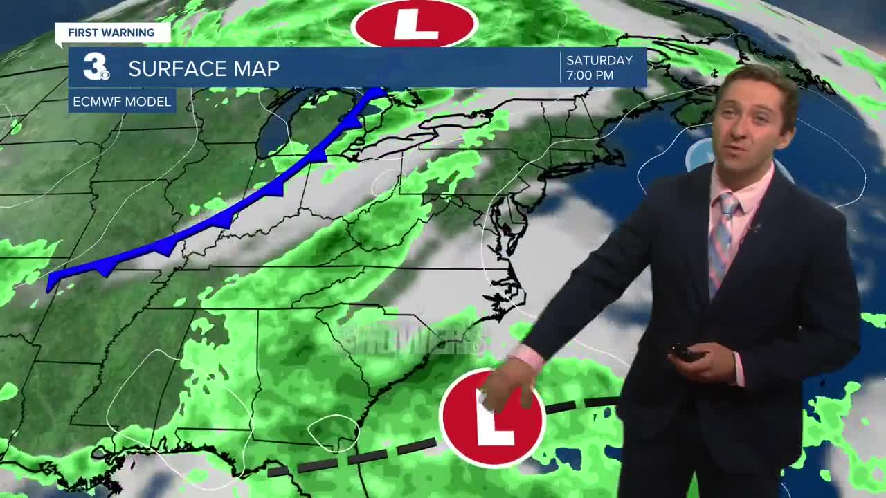
Tomorrow some showers are possible, especially during the morning hours in NE North Carolina. A weak low-pressure system will track offshore, bringing mostly cloudy skies and scattered showers followed by some clearing during the afternoon/evening. Highs will reach the low to mid 80s, with winds out of the E at around 10 mph. Rain totals will be less than 0.1" for most, with some isolated downpours producing heavier amounts.

On Monday a cold front will swing through, bringing some spotty showers in the morning along with dropping humidity during the afternoon. Dew points in the low 70s will fall to the upper 50s by Tuesday morning. Highs on Monday will reach the mid to upper 80s, with winds out of the NE at 5-15 mph and partly cloudy skies. On Tuesday temperatures drop to the upper 70s and low 80s, with very comfortable humidity as dew points struggle to make it above 60. The rest of the weak looks cooler than normal, with mainly dry conditions along with plenty of sunshine through Friday.


TRACKING THE TROPICS
Hurricane Erin has undergone extra-tropical transition and is now a post tropical cyclone over the Northern Atlantic. We are still dealing with some rough surf, but conditions have improved greatly and will continue to get better into next week.

The next storm to be named will likely occur over the next couple of days south of Bermuda. This storm will be named Fernand, and it is expected to stay well out to sea. This storm may produce some rough surf later next week/weekend; however its impacts will be minimal to our area.
Weather updates on social media:
