

Meteorologist Tony Nargi's First Warning Forecast
Today will start off clear with breezy and cool conditions. High temperatures will reach the 40s this afternoon, with winds out of the N at 10-20 mph, tapering off to 5-15 mph this evening. Clear conditions in the morning will give way to a mix of sun and clouds this evening. Overnight clouds will increase, with overcast skies and some rain expected late along with low temperatures in the upper 30s to low 40s.

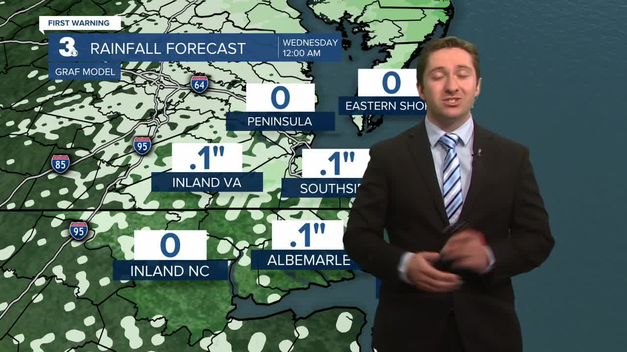
Tomorrow will start off with periods of rain. Some heavy rain will be possible at times during the morning hours, particularly on the Outer Banks. Rain during the morning will transition to on and off showers during the afternoon. High temperatures will reach the low to mid 50s. Winds will be out of the E at 10-20 mph, turning out of the NW during the afternoon. About 0.75" to 1.5" of rain can be expected, with amounts up to 3" possible on the Outer Banks. Overnight clouds will clear out, with mostly sunny skies expected by Wednesday. Wednesday will be dry with highs in the mid 40s along with winds out of the N at 10-15 mph.


After another dry day on Thursday, our new active pattern will continue, with another chance of rain moving in Friday afternoon into Saturday. Temperatures will stay cool, in the 40s to low 50s.


Weather updates on social media:
