

Meteorologist Tony Nargi's First Warning Forecast
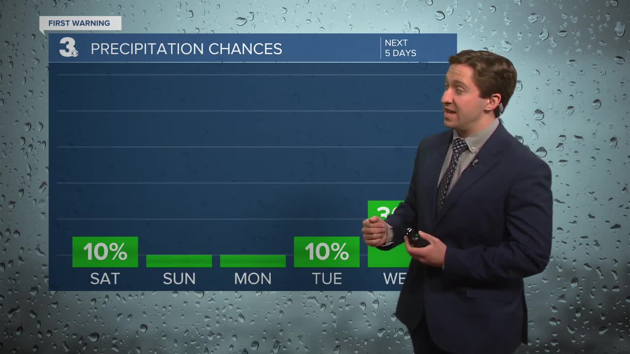
Today will be mostly sunny and cool, with temperatures starting off in the 40s but only reaching the upper 40s to low 50s for afternoon highs. It will be a windy day, with winds will be out of the NE at 10-20 mph. Tonight, will be clear and chilly, with overnight lows dropping into the 30s for most and even some upper 20s possible inland. Some patchy frost is likely, make sure to bring those plants indoors.


Tomorrow will be a step warmer, with high temperatures reaching the upper 50s to low 60s. It will be mostly sunny, with just a few passing clouds expected. Winds will be out of the S at 10-15 mph. Overnight lows will not be quite as cool, with temperatures dropping into the 40s. Monday will be even warmer, with high temperatures in the low to mid 70s. Winds will be out of the SW at 10-20 mph. Partly cloudy skies develop Monday afternoon with pleasant Spring weather returning.

Tuesday will be mostly sunny and warm, along with another warm day expected Wednesday. Some storms arrive late in the day on Wednesday, with cooling temperatures Thursday. Some wet weather moves in Thursday into Friday.

Weather updates on social media:
