

Meteorologist Tony Nargi's First Warning Forecast
This evening will be mainly dry with partly cloudy skies with a couple of stray showers possible. Overnight temperatures will drop into the low 60s and 50s, with breezy conditions continuing.

Tomorrow will start out mainly dry with partly cloudy skies. Some spotty showers are possible late in the day, but most of the area stays dry. Highs will stay below normal in the mid 70s. It will be a windy day, with winds out of the NE at 15-25 mph. Tidal flooding will be an issue thanks to the persistent onshore wind, with nuisance to minor flooding possible in low lying coastal areas. A coastal flood advisory is in effect between 8 am and 2 pm tomorrow. Overnight showers will remain possible as a coastal low tries to develop offshore.


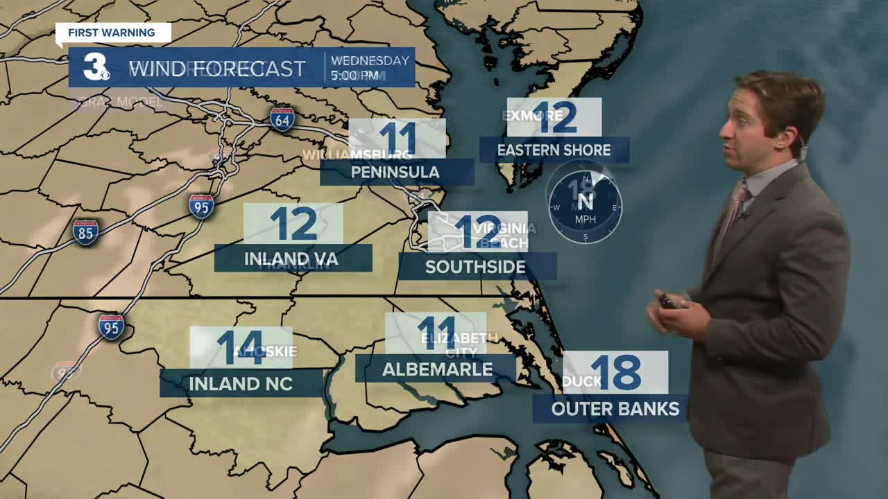
Wednesday will be mostly cloudy with spotty showers expected across the area. Highs will stay below normal in the mid 70s. It will be a bit less windy, with winds out of the N at 10-15 mph. Nuisance tidal flooding will remain possible. On Thursday things are expected to dry out, with spotty showers in the morning turning to dry conditions in the afternoon with partly cloudy skies. Highs on Thursday will reach the mid to upper 70s.

The rest of the week looks nice, with mainly dry conditions and partly cloudy to mostly sunny skies expected. High temperatures will stay on the cooler side of things in the mid to upper 70s.

TRACKING THE TROPICS

Nothing to see here! The peak of hurricane season occurs on September 10th, and remarkably no tropical activity is expected over the next seven days. Things become more favorable for development next week, we'll keep you updated if anything changes.
Weather updates on social media:
