


Meteorologist Myles Henderson’s First Warning Forecast
Another cool, cloudy, and breezy day. Warming back to the 80s to end to the week. Tracking a threat for severe storms on Friday. Feeling more like summer for Memorial Day weekend.
Overcast skies with on and off showers will continue today as an area of low pressure lingers over the Mid-Atlantic. It will be breezy again today with NE winds at 10 to 20 and gusts near 25 mph. Temperatures will linger in the 60s, at least 10 degrees below normal for this time of year.
Get ready for a warming trend for the end of the week. Highs will climb to the low 80s Thursday, near or just above normal. We will see mostly cloudy to partly cloudy skies with a few lingering showers possible.

Showers and storms will return for Friday as a cold front moves in. The biggest rain chances will be Friday afternoon to evening with strong to severe storms possible. Highs will warm to the mid 80s on Friday and humidity will increase.

Memorial Day weekend will be what you’d expect for the unofficial kickoff to summer. A little on the warm side with highs in the low to mid 80s. Expect a mix of sun and clouds with small chances for a “pop-up” shower or storm (20-30%).
Today: Cloudy, Showers, Windy. Highs in the mid 60s. Winds: NE 10-20G25
Tonight: Cloudy, Showers. Lows in the mid 60. Winds: E 5-15
Tomorrow: Mostly to Partly Cloudy. Highs near 80. Winds: E/SE 5-10
Weather & Health
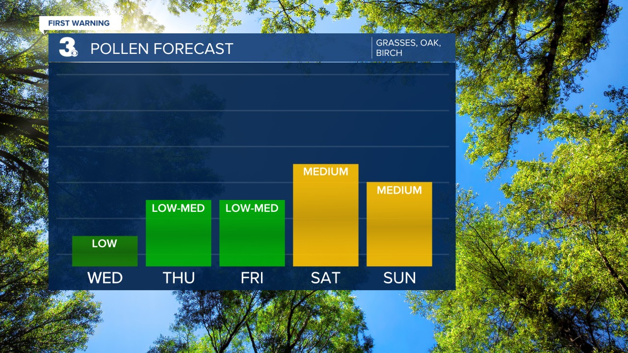
Pollen: Low (Grasses, Oak, Birch)
UV Index: 2 (Low)
Air Quality: Good (Code Green)
Mosquitoes: Very High
Weather updates on social media:
Facebook: MylesHendersonWTKR
Twitter: @MHendersonWTKR
Instagram: @MylesHendersonWTKR
