


Meteorologist Myles Henderson’s First Warning Forecast
A nice break from the heat and humidity today. Tracking showers and storms this weekend. Another hot and humid stretch to start next week.
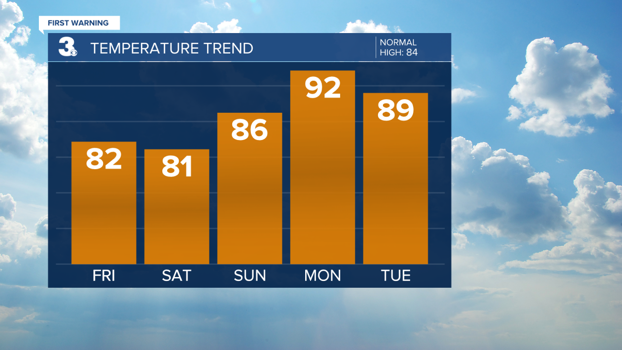
Cooler, less humid, and more sunshine to end the work week. Highs will only reach the low 80s today, almost 10 degrees cooler than yesterday. It will feel much nicer because of a drop in the humidity (dew point in the 50s versus the 70s). Expect sunshine today with a few clouds mixing in.

We will start with some sunshine on Saturday, but clouds will build through the day. Watch out for scattered showers and storms in the afternoon to evening. Highs will return to the low 80s.
Expect a mix of partly to mostly cloudy skies Sunday with scattered showers and storms. Highs will warm to the mid 80s and humidity will start to build. While both weekend days have rain chances, neither day is looking like a total washout.
The summer-like heat and humidity return next week. Expect highs in the low 90s with and an afternoon heat index in the mid 90s on Monday. Rain chances will be low for the first half of the week.
Today: A Few Clouds, Less Humid. Highs in the low 80s. Winds: N/E 5-15
Tonight: A Few Clouds. Lows in the mid 60s. Winds: S 5-10
Tomorrow: AM Sun, PM Clouds, Scattered Storms. Highs in the low 80s. Winds: N/E 5-10
Weather & Health
Pollen: Medium (Grasses)
UV Index: 9 (Very High)
Air Quality: Good (Code Green)
Mosquitoes: Extreme
Tropical Update
No tropical activity at this time
Weather updates on social media:
Facebook: MylesHendersonWTKR
Twitter: @MHendersonWTKR
Instagram: @MylesHendersonWTKR
