Meteorologist Maddie Kirker's First Warning Forecast:
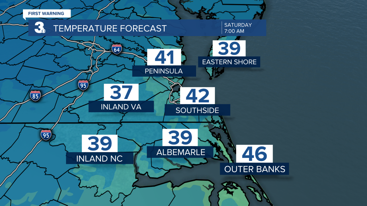
The relentless wind we've felt over the past few days, will finally relax tonight. This along with clear skies will set the stage for a chilly start to the weekend. Temperatures will drop to the low 40s by sunrise Saturday morning.
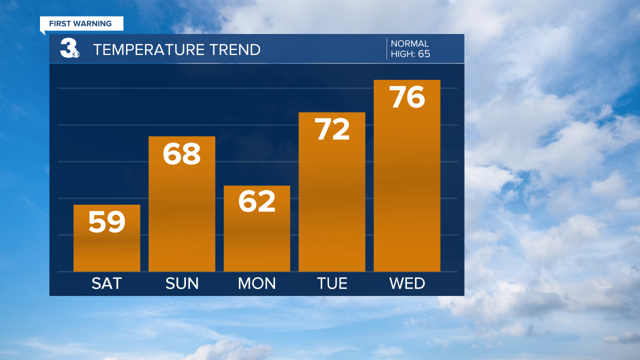
Our Saturday will mainly feature wall-to-wall sunshine until clouds build back in late in the afternoon to evening. Highs will only be in the upper 50s sharply cooler than our Friday. Oh ya - Don't forget to check out the Gloucester Daffodil Festival happening Saturday (and Sunday) this weekend! If you plan on going Saturday, bring a jacket!

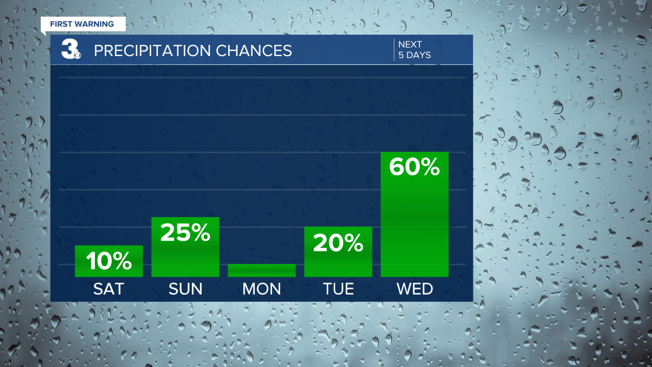
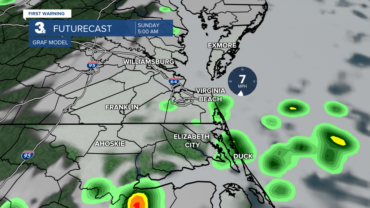
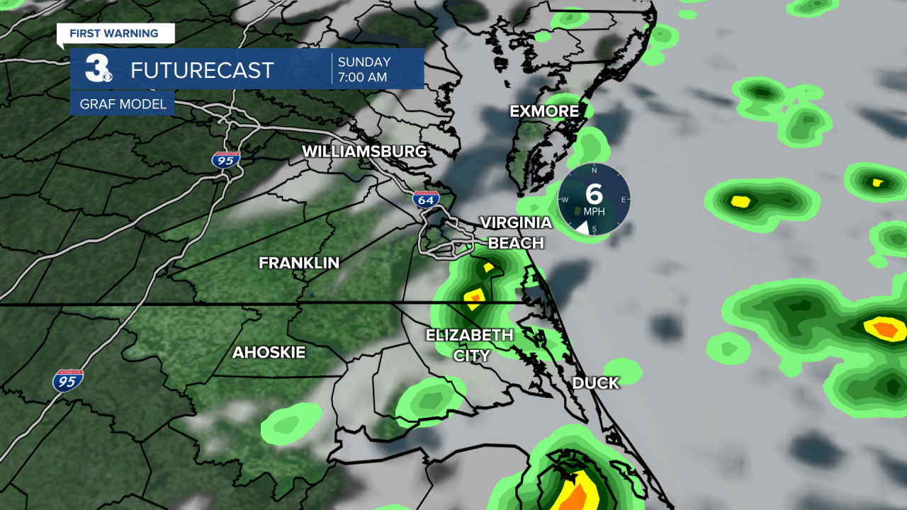
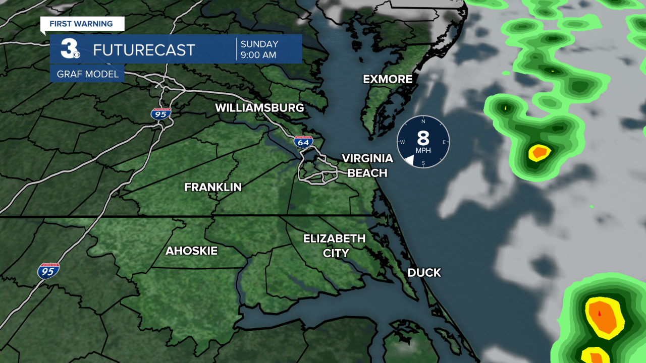
Speaking of the weekend, we're tracking a round of showers very late Saturday night into early Sunday morning. This shouldn't impact the Daffodil Festival at all. As of now, rain is expected before 8am, then we will return to sunshine by Sunday afternoon. Highs will be warmer Sunday and in the upper 60s. Below is a look at when the rain moves in, and out, early Sunday.
It'll be a nice start to next week with sunshine and 60s on Monday. It'll be even warmer Tuesday with highs in the low 70s out ahead of our next two storm systems that will move in Wednesday and Thursday. Despite the increased rain chances, highs by Wednesday and Thursday will soar to the mid and upper 70s.