

Meteorologist Tony Nargi's First Warning Forecast
After a warm and humid end to the month of July relief has arrived to start off August in the form of cooler temperatures and eventually lower dew points!
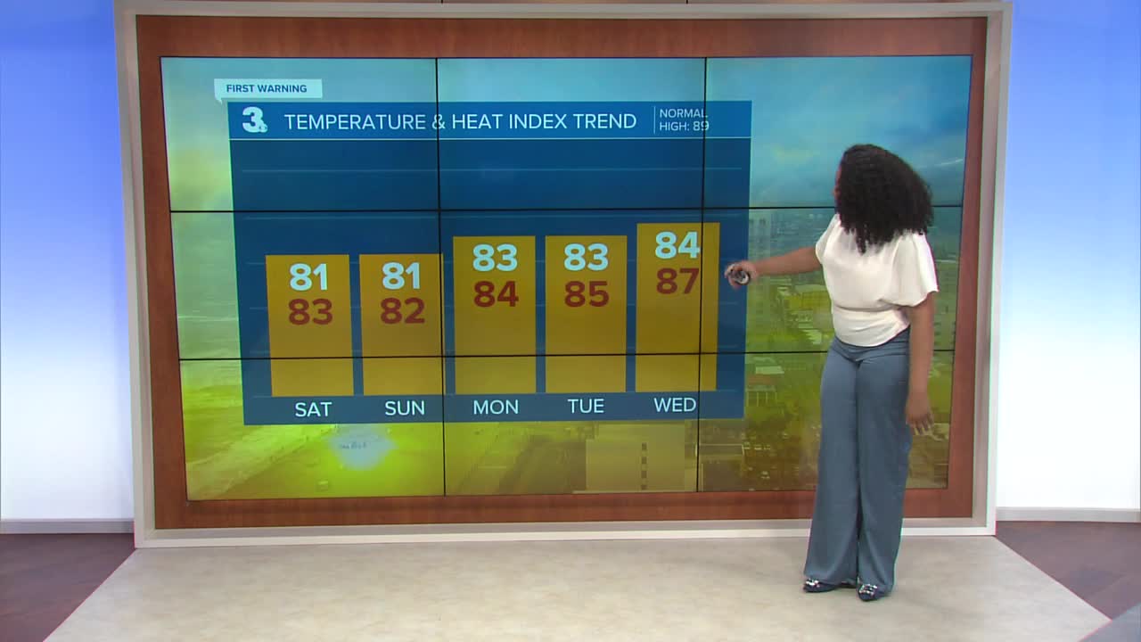
We still have mostly cloudy skies with a chance for some scattered showers and downpours tonight. Low's will drop into the low to mid 70s.

Tomorrow will start off with isolated showers then clearing is expected later in the day with sunny skies by the late afternoon! Highs will reach the low 80s, with dew points dropping below 70 by the end of the day, giving us a nice break from the humidity. It will be breezy, with wind out of the NE at 10-20 mph gusting to 30 mph at times. Gusty northeast winds will lead to some rough surf, with a high risk of rip currents expected tomorrow.


Next week will start out lovely, with mainly sunny skies expected for Sunday along with high temperatures in the low 80s. It will be comfortable with dew points staying in the low 60s. It will remain a bit breezy, with winds out of the NE 10-20 mph, gusting to 30 mph at times.

Check out the Interactive Radar on WTKR.com: Interactive Radar
