

Meteorologist Tony Nargi's First Warning Forecast
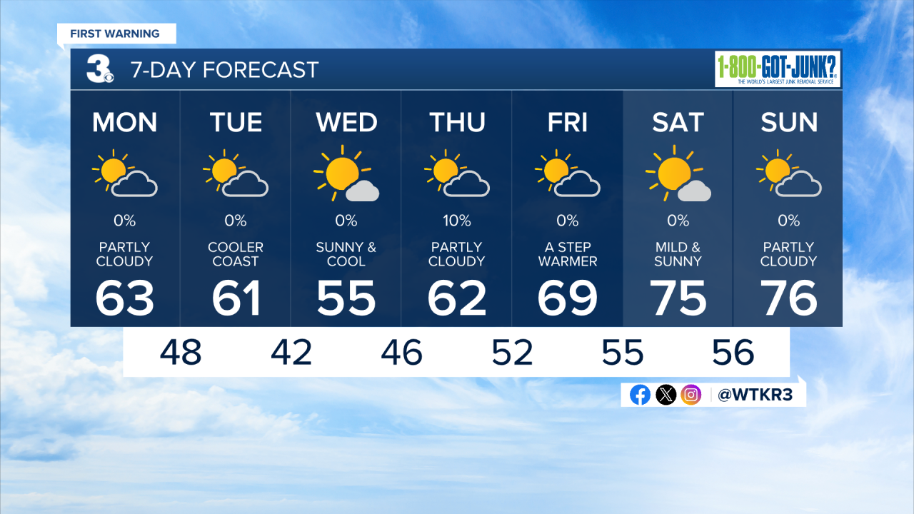
This morning will start off cooler around 50 with breezy conditions early. Today will be partly cloudy and cooler with high temperatures around 60 along with light winds out of the NW, turning out of the SW during the afternoon. Tonight will be cool with lows dropping into the 40s.

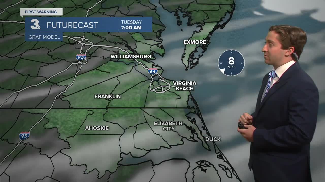
Tomorrow will be partly cloudy with highs in the low 60s, with 50s along the coastline. There will be elevated fire concerns for our far western areas that didn't see as much rain yesterday. Overnight lows will drop into the upper 30s to low 40s, with frost/freeze concerns for far inland areas as well. Wednesday will be the coolest day of the week, with highs in the 50s along with sunny and breezy conditions.

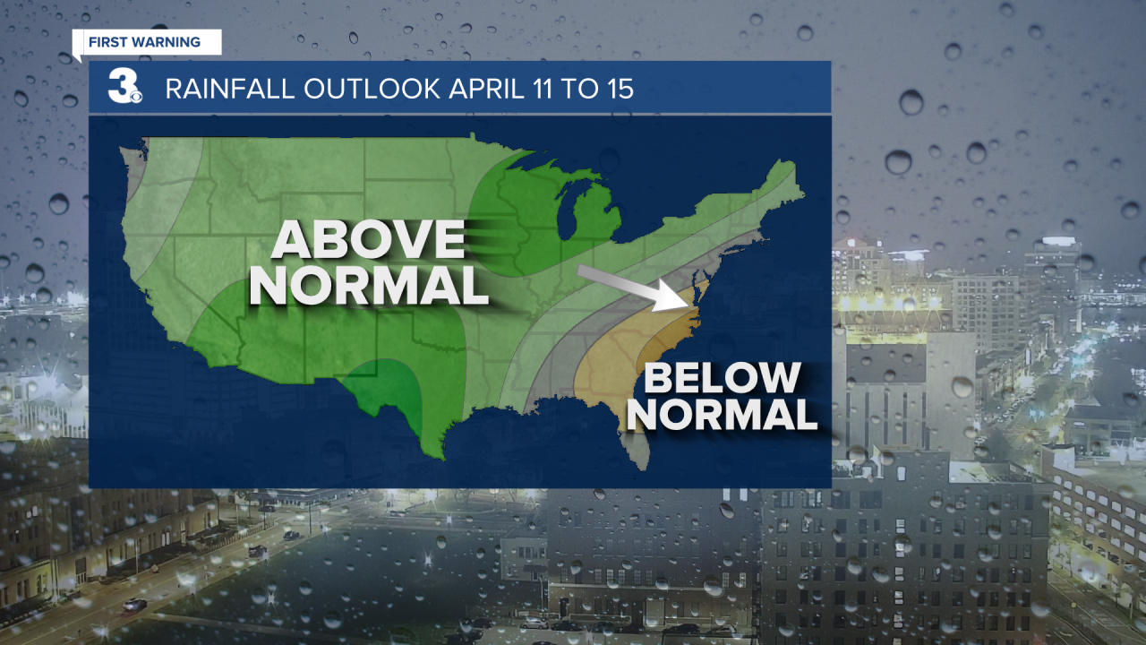
Dry conditions persist for the entire week. We may go 10 days before we see another drop of rain in Hampton Roads. After a dry March, drought concerns will increase. Temperatures slowly warm back into the 70s this weekend.
Weather updates on social media:
