

Derrah Getter's First Warning Forecast
Today will be another rough and windy day at the beach.

There is a high rip current risk in place for all area beaches. Surf height is forecast to reach 9 feet at times. Dangerous breaking waves can cause neck and spinal cord injuries.

High temperatures this afternoon reach the upper 70s and low 80s. The windy conditions continue with northeasterly winds at 15-20 mph. A few spotty showers will be possible this afternoon. Tonight lows dip into the upper 60s and low 70s.

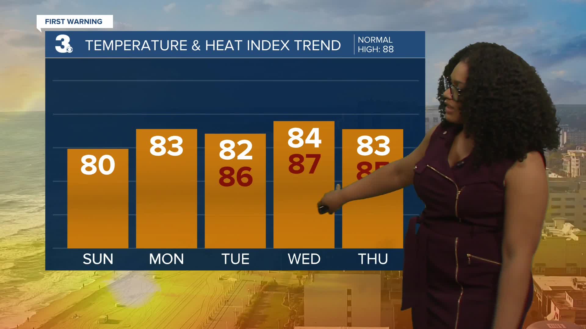
The below normal conditions and low dew points prevail this week giving us an early taste of fall. Highs all throughout the week will be in the low to mid 80s. Scattered showers and storm chances return at the end of the week.

2025 Atlantic Hurricane Season Update
As of 8/3 at 8 am:
There are two areas of development. The first is about 180 miles off the North Carolina coast. It could briefly become a tropical depression but it is expected to move into cooler waters where it will weaken next week. The second area of development is a wave that is forecast to form off the west coast of Africa within the next couple of days. Gradual development is possible next week.

Let's connect on social media!
Forecaster Derrah Getter:
For weather updates on Facebook: HERE
For weather updates on X: HERE
Follow me on Instagram: HERE
Check out the Interactive Radar on WTKR.com: Interactive Radar
