

Derrah Getter's First Warning Forecast
The heat and humidity crank up today!
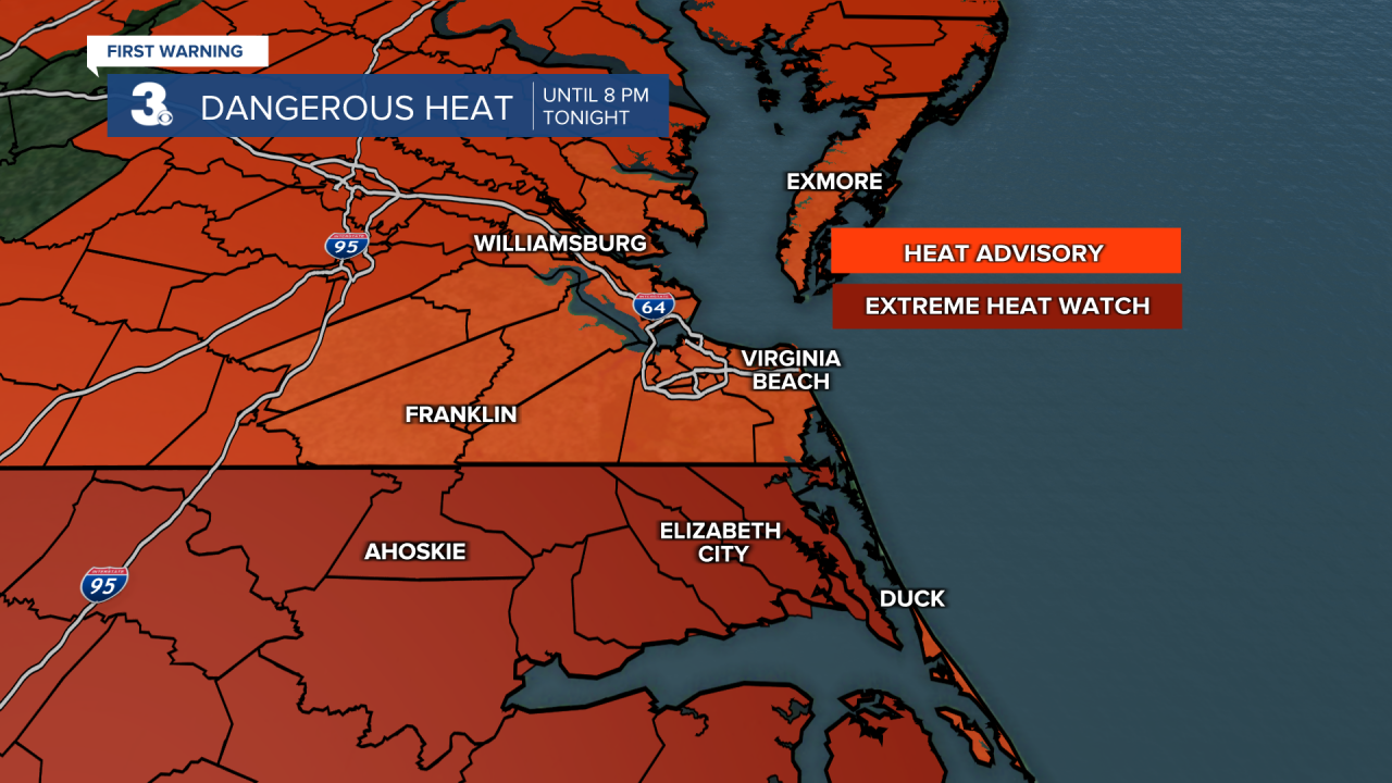
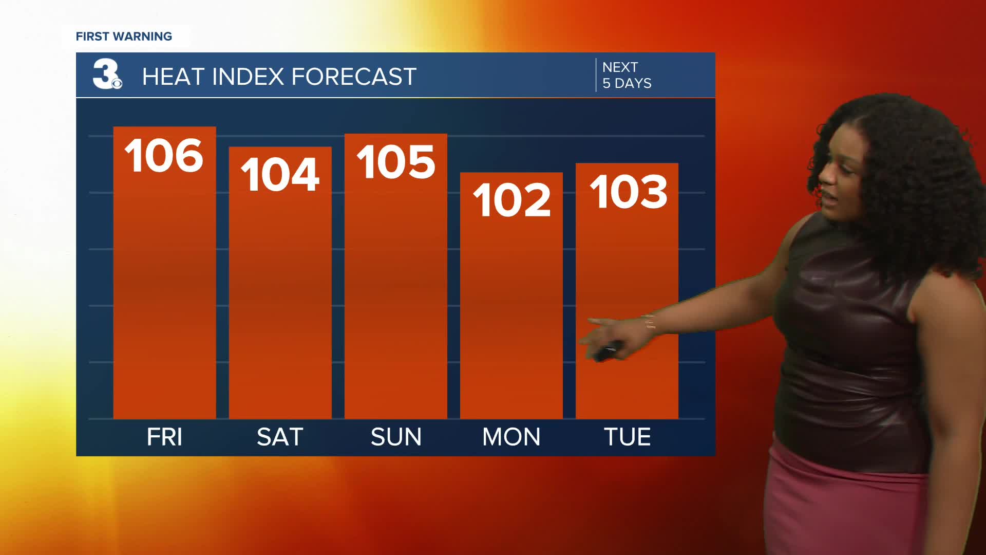
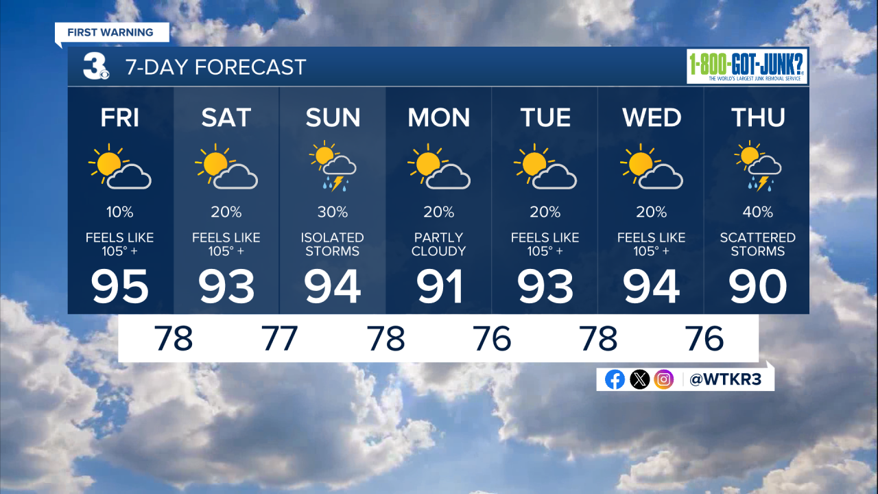
The humidity will be noticeably higher than in the last 48 hours. This afternoon we reach the mid 90s with feels like temperatures near 105 or more. A heat advisory is in effect for the entire area until 8 pm. Northeast North Carolina is under an extreme heat watch until 8 pm where “feels like” temps could surge to near 110.

This weekend the heat doesn’t let up. Highs will be in the mid 90s both days with heat index values near 105 degrees. There will be slightly higher storm chances Sunday, but overall rain chances will be low.
We hang on to the mainly dry and hot conditions throughout most of next week. Scattered storms arrive late week as temperatures retreat to the upper 80s and low 90s.
2025 Atlantic Hurricane Season Update
8 am
A broad area of low pressure over the northern central Gulf is producing an area of disorganized showers and thunderstorms. Slow development is possible over the next day but ultimately the system will weaken as it moves inland near Texas and Louisiana.

Let's connect on social media!
Forecaster Derrah Getter:
For weather updates on Facebook: HERE
For weather updates on X: HERE
Follow me on Instagram: HERE
Check out the Interactive Radar on WTKR.com: Interactive Radar
