


Meteorologist Maddie Kirker's First Warning Forecast:
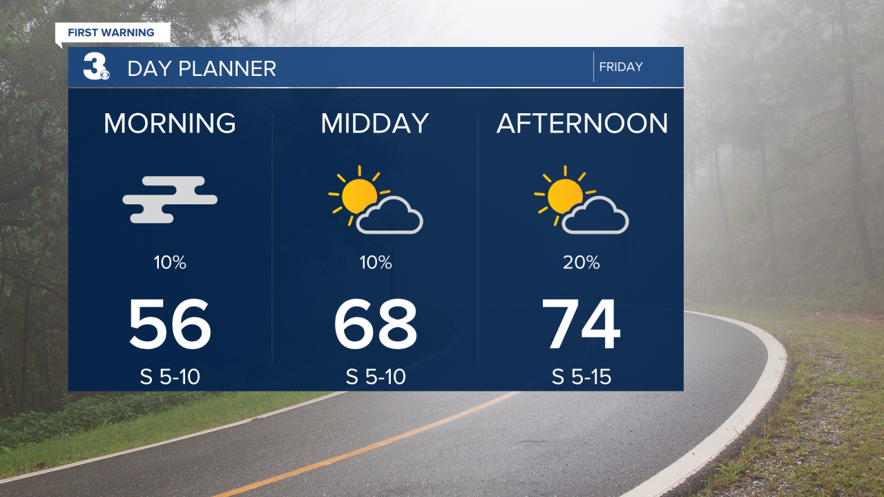
Happy Friday! After a very foggy start, most of the area will enjoy a pleasant day with partly to mostly sunny skies and highs in the low to mid 70s. Sea fog will be possible right along our ocean waters this afternoon, including the OBX and Virginia Beach thanks to the onshore breeze. Winds will be breezy out of the southeast and south between 5 and 15 mph.
Our next cold front will approach the area Friday night and move in on Saturday. This will also bring us our next chance for severe weather. Showers and storms will develop out ahead and along the front as it moves through mainly early Saturday to Saturday afternoon. Storms could become strong to severe with damaging winds, hail and even an isolated tornado.

Risk of severe weather will end as the storms move offshore during the late afternoon and evening. As the front moves through, it'll be windy, SW at 10 to 20 mph, with gusts to 30 mph. Temperatures will drop behind the cold front from the 80s on Saturday to the mid 60s on Sunday. Sunshine will return for Sunday and winds will back down as we kick off the first day of Spring.

Things are trending rather quiet as we head back to work Monday and Tuesday. Highs will be in the upper 60s both days with mostly sunny skies.
