

Meteorologist Tony Nargi's First Warning Forecast
This evening will be pleasant with temperatures dropping into the 60s and 50s for some with mainly clear skies expected. Winds will diminish from 10-15 mph out of the NE at 5-10 mph.
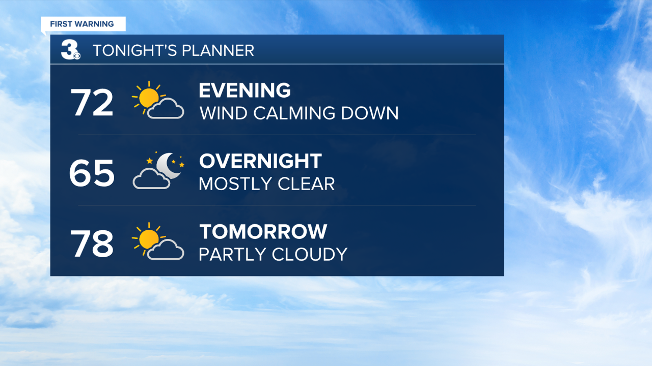
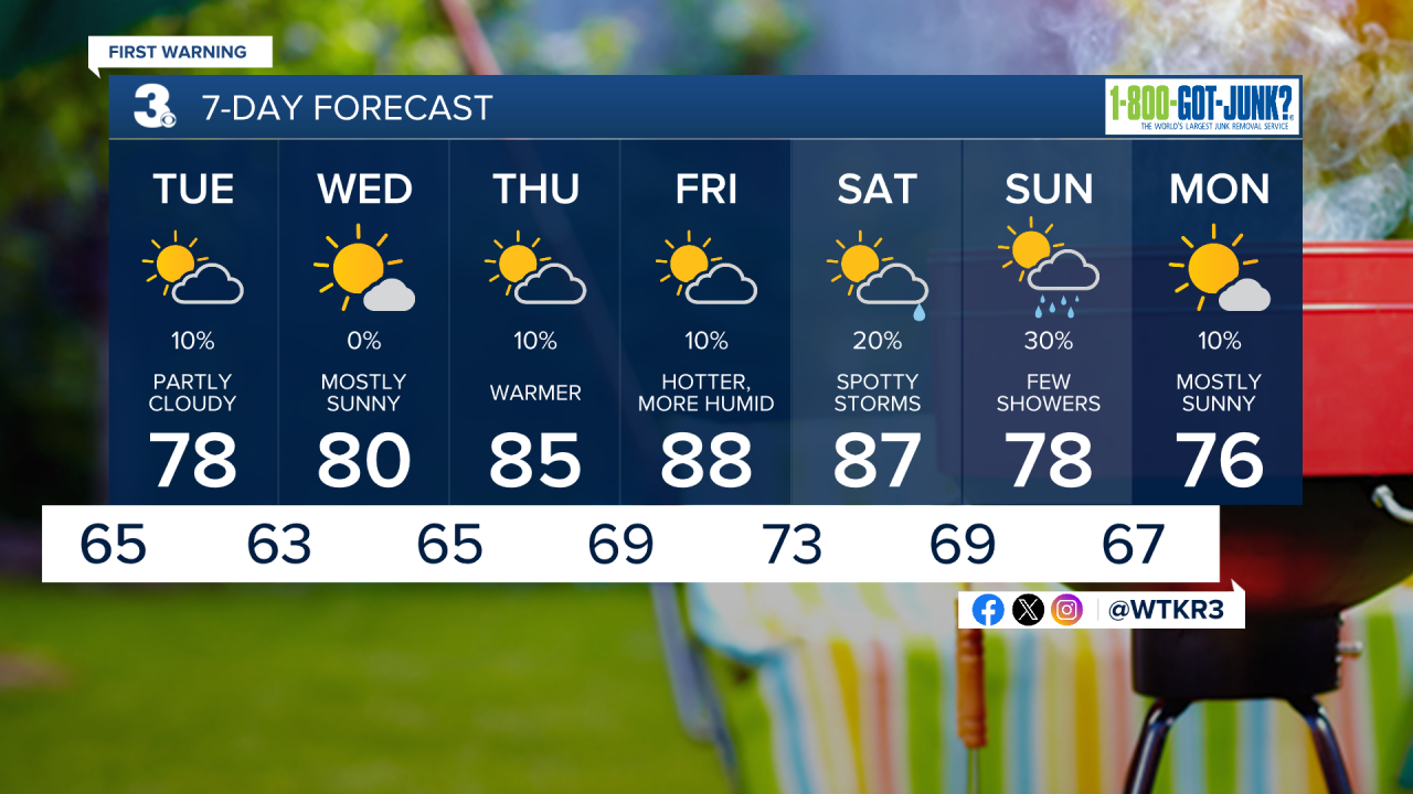
Tomorrow will be comfortable, with highs in the mid to upper 70s along with dew points near 60. Winds will be light out of the NE at 5-10 mph, 10-15 mph along the immediate coastline. There's a 10% chance of seeing a stray shower during the afternoon, with mainly dry conditions expected. Skies will start out sunny with partly cloudy skies expected during the afternoon. Surf conditions are expected to be a bit rough, with 3-5 feet waves and a high risk of rip currents.

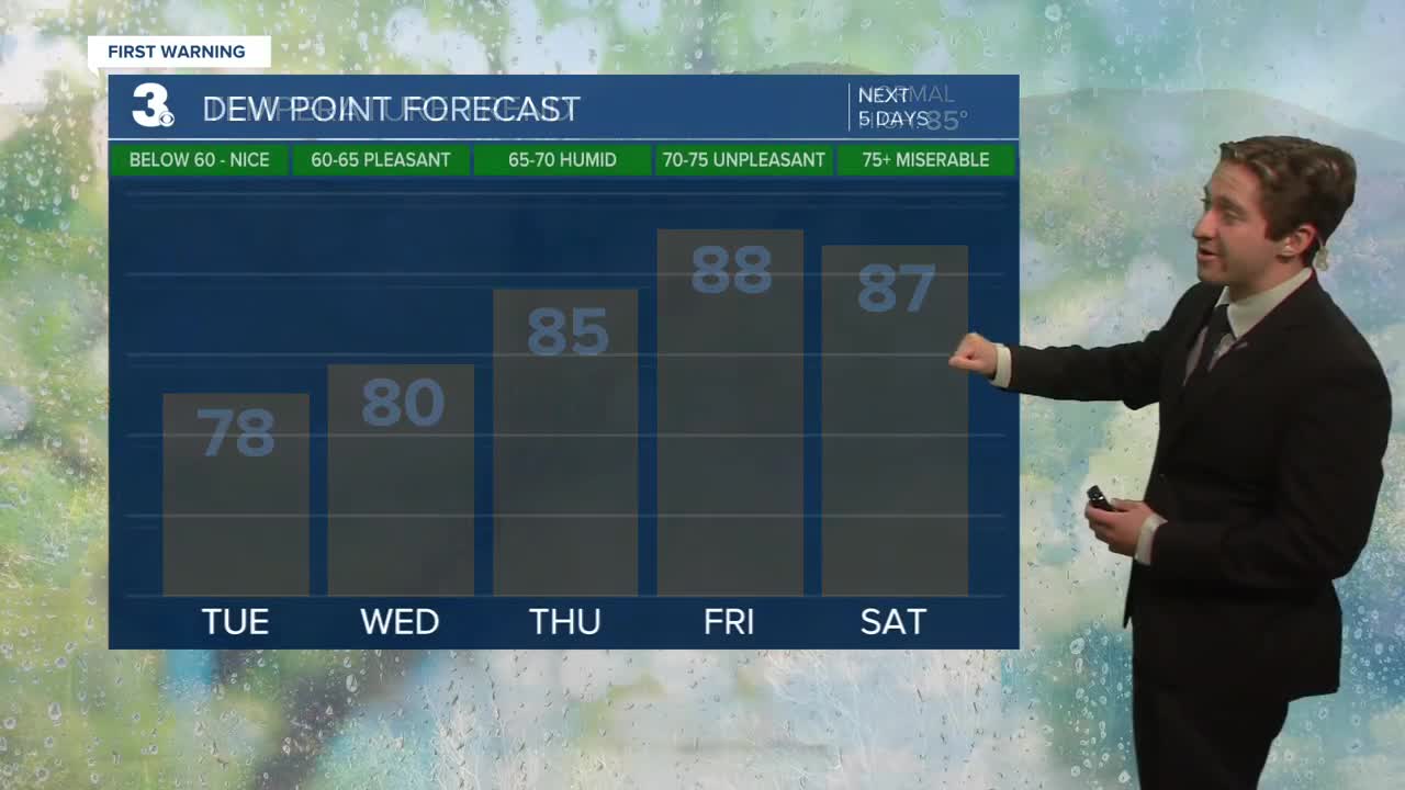
Wednesday will be another comfortable day, with highs reaching the upper 70s to low 80s along with dew points in the low 60s. Winds will be light out of the NE at 5-10 mph. We'll see mainly sunny skies along with dry conditions expected. On Thursday heat and humidity will start to build back in, with highs jumping into the mid 80s along with dew points in the mid 60s. We'll see a low-end chance for spotty thunderstorms, along with partly cloudy skies.

By the end of the week heat and humidity really starts to build, with highs reaching the mid 80s to near 90 on Friday and Saturday along with dew points in the 70s. We'll see the chance for some isolated thunderstorms this weekend as well, with Sunday bringing the highest chance of some rain.
TRACKING THE TROPICS
There is one area of interest in the Main Development Region (MDR) of the Atlantic, with a 50% chance of development over the next 7 days and 10% chance of developing in the next 2 days. Should this tropical wave develop into a tropical depression, it will continue to move west over warm water while battling some significant wind shear. We'll keep you updated throughout the week on the movement of this potential area of development.

Weather updates on social media:
