

Meteorologist Tony Nargi's First Warning Forecast
Today will start off with some morning fog and a few leftover clouds. Temperatures will start in the 40s, with light winds out of the N at 4-8 mph. This afternoon winds will turn out of the W at 5-10 mph. We'll see plenty of sunshine this afternoon with highs in the low 60s. Overnight we'll see clear skies with low temperatures falling into the 40s and upper 30s.

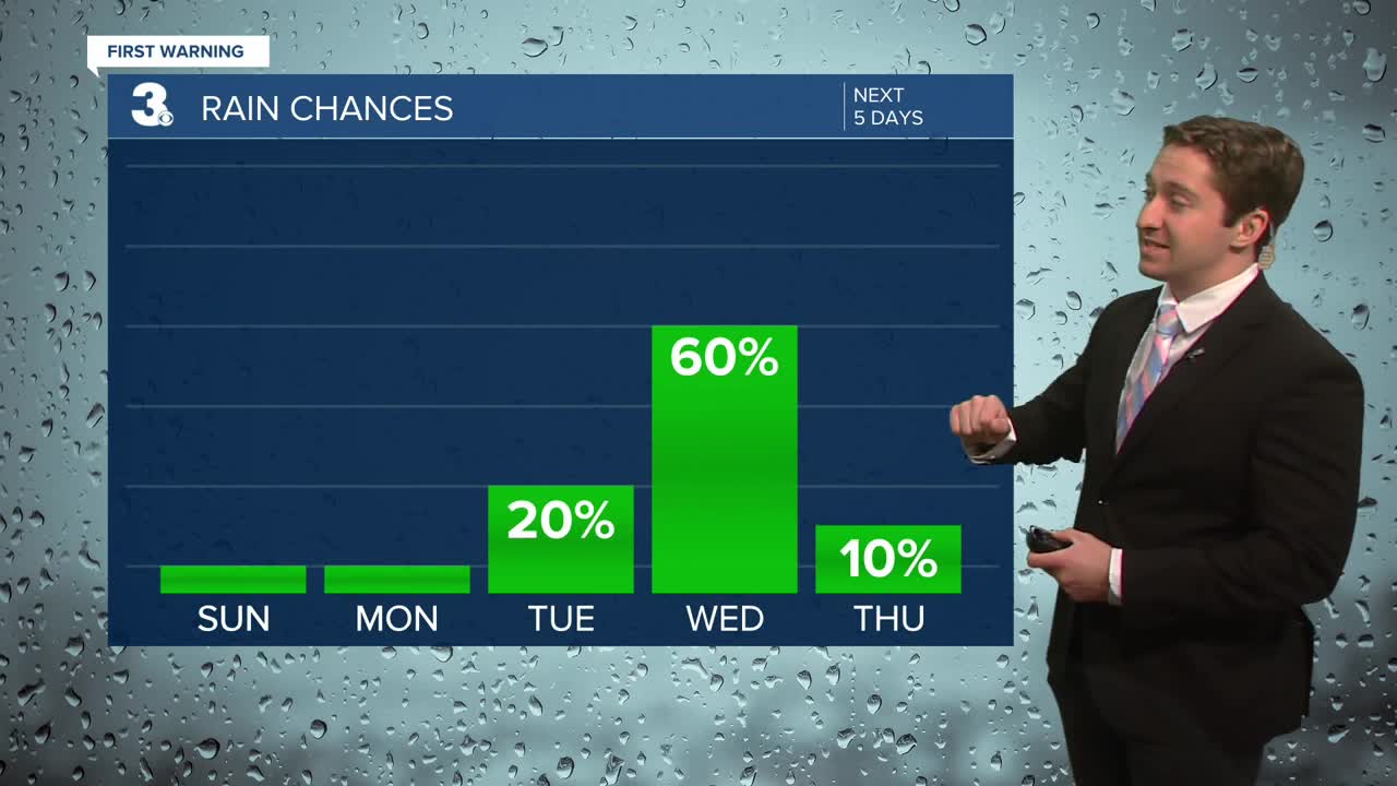
Tomorrow will be pleasant with mainly sunny skies along with light winds out of the NE at 5-10 mph. We'll see high temperatures in the mid 50s. A few afternoon clouds are possible. Monday night temperatures will fall back down into the upper 30s to mid 40s. On Tuesday winds will pick up out of the S at 10-15 mph. We'll see sunshine on Tuesday morning, with clouds increasing throughout the day. We'll see mostly cloudy skies by Tuesday afternoon with above normal high temperatures, in the upper 60s to near 70. A stray shower is possible towards the end of the day.


Tuesday night into Wednesday we'll see showers move in ahead of a cold front. On Wednesday we'll see scattered showers and some thunderstorms as a cold front passes through the area. Temperatures will drop by Thanksgiving with drier and cooler weather expected to end the week.

Weather updates on social media:
