Meteorologist Maddie Kirker's First Warning Forecast:
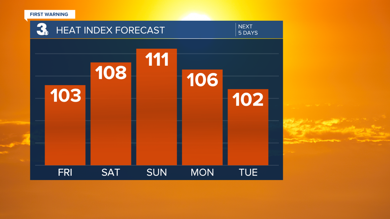
We're starting this Friday a little cooler with temperatures in the mid 70s. Highs will be in the low to mid 90s today with cooler feels-like conditions between 100 and 105.
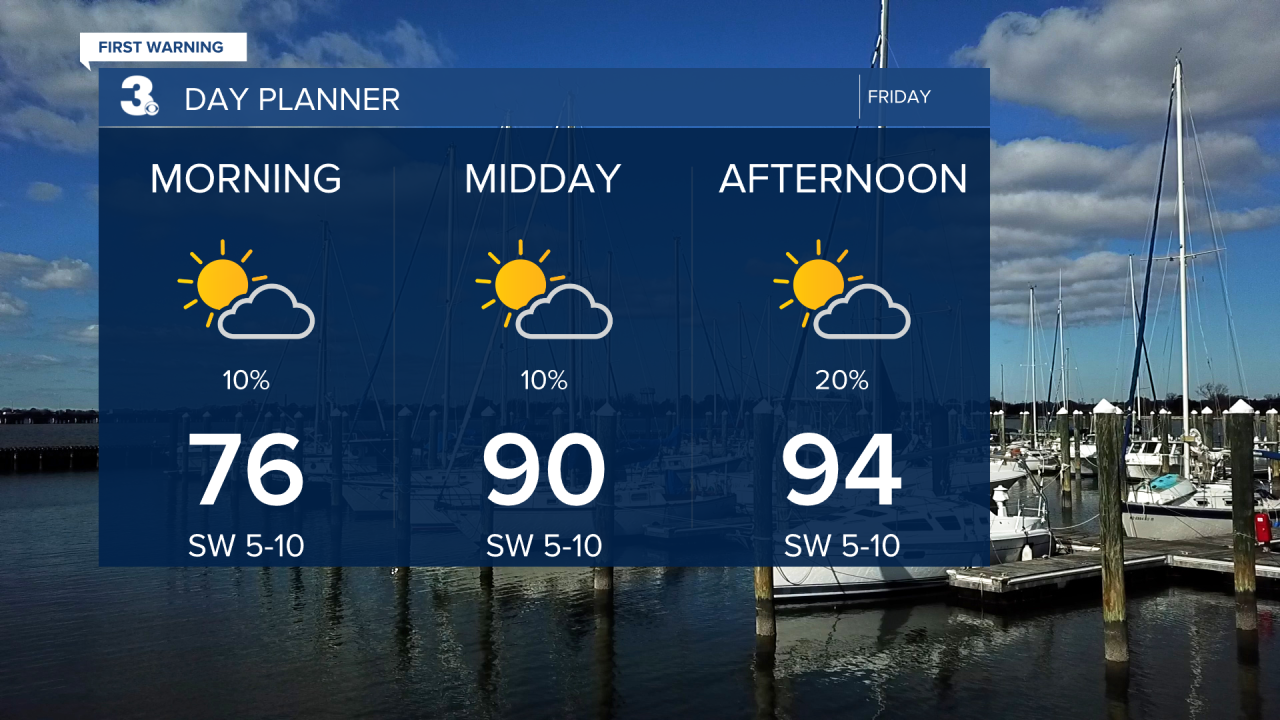
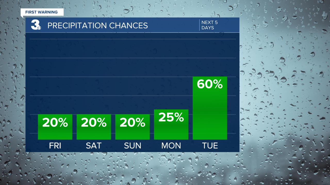
A few storms are moving north towards the southern OBX this morning, but the rest of the area is dry. Other than this activity in North Carolina, expect mainly dry conditions today with only a stray storm possible (20%). The wind will be calmer today out of the southwest between 5 and 10 mph.

Get ready for more extreme heat this weekend. Highs will soar to the upper 90s Saturday and Sunday and parts of the area could actually touch the 100s with heat index values between 105and 115 degrees. Unfortunately, Saturday and Sunday look mainly dry, with only the potential of a pop-up shower or storm (20%).
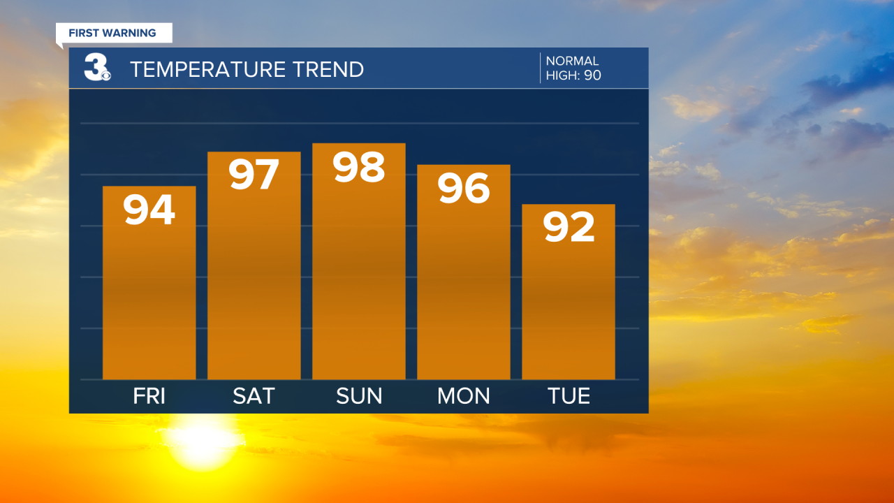
As we return back to work, storm chances will go up. Tuesday and Wednesday will feature scattered showers and storms. Although Monday will still be hot, highs by Tuesday and Wednesday will drop to the low 90s, closer to normal for this time of year.