

Meteorologist Tony Nargi's First Warning Forecast
This evening will be mild, with temperatures only dropping off into the upper 40s. Winds will be out of the SW at 5-10 mph. Overnight lows will only reach the mid 40s, with mostly cloudy skies developing.

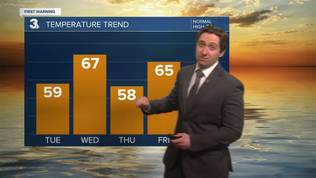
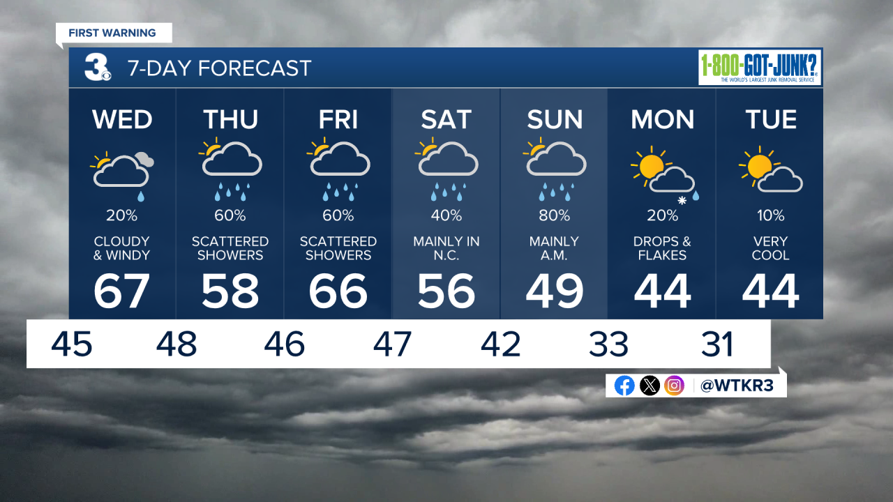
Tomorrow morning will start out mostly cloudy, with winds increasing throughout the morning out of the SW. By the afternoon it will be cloudy and breezy, with winds staying out of the SW at 10-20 mph, gusting up to 35 mph at times. It will be mild, with high temperatures reaching the upper 60s to near 70. A stray shower is possible during the afternoon. Overnight will be cloudy with temperatures only dropping into the mid to upper 40s.


Thursday will be cloudy with showers expected to develop throughout the morning. Showers in the morning will last through the evening. We'll see high temperatures in the upper 50s to low 60s with winds out of the ENE at 10-15 mph. Overnight showers will continue with lows dropping into the 40s. Friday will be warmer with highs in the 60s along with showers expected during the morning. Showers will start to taper off Friday night.

Saturday looks mainly dry during the morning, with a few showers possible in Northeast North Carolina during the afternoon. More widespread rain is expected Saturday night into Sunday morning, before clearing Sunday afternoon.
Weather updates on social media:
