


Meteorologist Myles Henderson’s First Warning Forecast
*** Coastal Flood Warning until 7 AM Tuesday for the Outer Banks of Dare County and until 3 PM Monday for Accomack County.
*** Coastal Flood Advisory from 7 AM to 11 AM Monday for Northampton County.
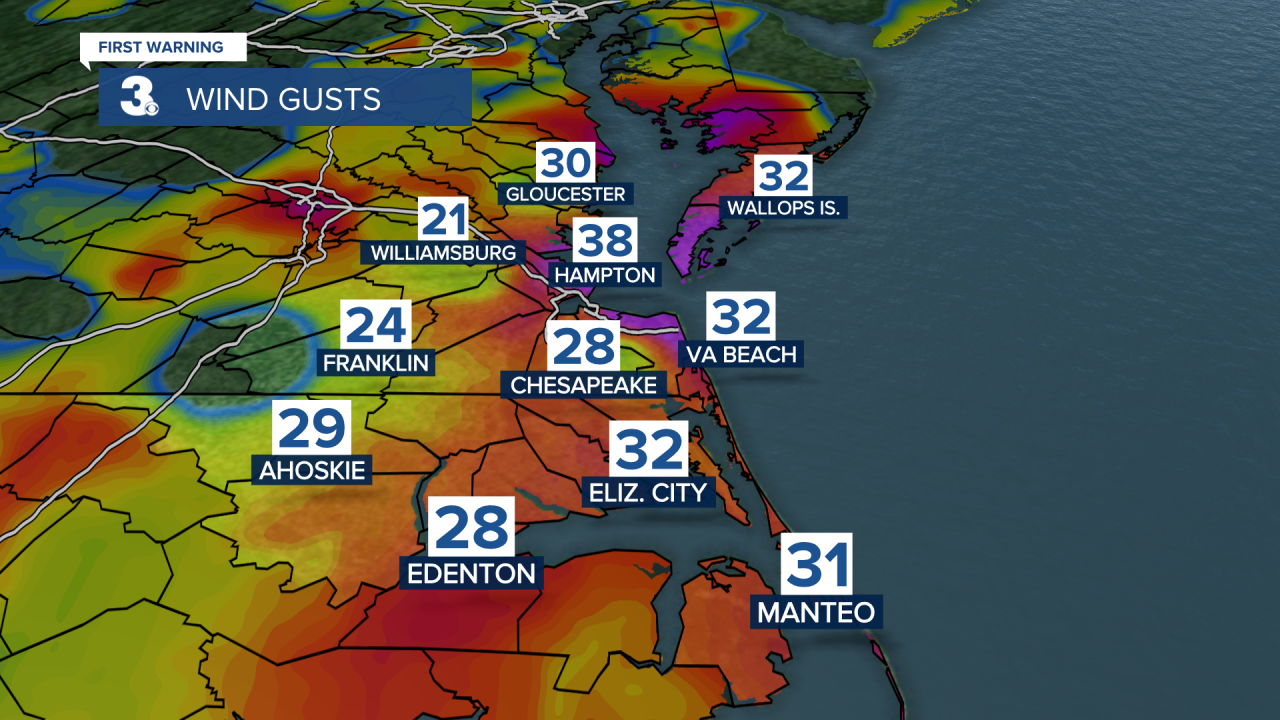
Clearing out but extremely windy… Expect west to SW winds today at 15 to 25 with gusts to 40 mph. These winds will trigger some flooding on the Chesapeake Bay side of the Eastern Shore and sound side of the Outer Banks.
Clouds will clear out this morning with sunshine through midday. Clouds will return this afternoon to evening. Temperatures will reach the mid 40s this afternoon.
Sunshine will return tomorrow with highs in the mid 40s. We will warm to the mid 50s on Wednesday with partly cloudy skies.
Rain will move in with a cold front Thursday morning but could change over to snow in the afternoon to evening as temperatures fall from the 40s to 30s. Rain and snow chances will linger for Friday and Saturday as the front stalls out near the coast. Highs will only reach the low to mid 30s to end the week.
Today: Mix of Sun & Clouds, Windy. Highs in the mid 40s. Winds: SW/W 15-25G40
Tonight: Clearing Skies, Windy. Lows in the upper 20s. Winds: W 10-20
Tomorrow: Mostly Sunny. Highs in the mid 40s. Winds: W 10-15
Weather updates on social media:
Facebook: MylesHendersonWTKR
Twitter: @MHendersonWTKR
Instagram: @MylesHendersonWTKR
