

Meteorologist Tony Nargi's First Warning Forecast
Today will be cloudy and gloomy with on and off drizzle expected throughout the day, along with spotty (30% chance) showers. Highs will reach the mid to upper 70s, with winds out of the N at 5-10 mph. Surf height will be 1-3 feet, with a low chance of rip currents expected. Overnight temperatures fall back into the 60s with spotty showers continuing.

Tomorrow will be cloudy with spotty showers in the morning transitioning into scattered (40% chance) showers during the afternoon. Highs will be in the mid to upper 70s, with winds out of the NE at 10-15 mph. Tropical Depression Nine (soon to be Imelda) will start to move closer to us on Monday, however recent trends keep the storm far offshore, leaving us with little impacts. With Imelda staying further offshore, expect just scattered showers on Tuesday (steady rain OBX), with windy conditions out of the NE at 15-25 mph. Rainfall totals will be less than 0.5" in SE VA, with between 0.5" to 2" of rain possible on the Outer Banks and southern parts of NE NC. Highs will be in the low to mid 70s.

Wednesday will be another windy one with clearing skies. Highs will be below normal in the low to mid 70s. By Thursday highs drop into the upper 60s and low 70s, with winds starting to calm down by Thursday and Friday.

TRACKING THE TROPICS
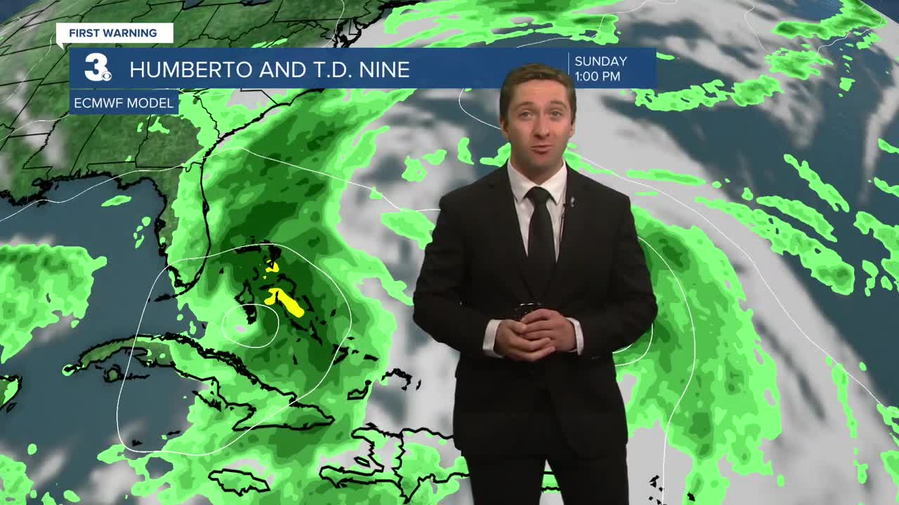
Hurricane Humberto is still chugging along in the SW Atlantic, now a high end category 4 hurricane undergoing an Eyewall Replacement Cycle. It will likely maintain its major hurricane status through the middle of the week, as it tracks about 500 miles offshore of Cape Hatteras. We'll see almost no direct impacts from Humberto, but we should be thanking it!


Tropical Depression Nine (soon to be Imelda) has continued to trend away from making landfall and trending towards staying further away from the coast, a trend we first noticed Friday night and Saturday morning.

This is due to models picking up the influence that Hurricane Humberto will have on TD9. As Hurricane Humberto strengthened into a major hurricane and eventually a category 5 hurricane yesterday, models continued to trend away from TD9 making landfall, and away from TD9 stalling off the coast of South Carolina. This is thanks to the Fujiwhara effect, where the influence of Humberto will steer Imelda away from a land-falling track. This trend is also in part thanks to the strength of Humberto, which models likely underestimated how much of an influence it would have until it underwent rapid intensification and eventually became a cat 5.

IMPACTS: The forecast is for TD9 to strengthen into a category 1 hurricane and stay almost 200 miles off the SC coastline, keeping heavy rain offshore and keeping almost all the rain away from our viewing area. The disastrous situation that models were calling for Thursday/Friday is no longer on the table. The highest amounts of rain will be in the Bahamas, with the SC coastline seeing 2-5" of rain rather than 10-20" of rain well inland. Here at home, I expect SE VA to see <1" of rain, with 1-2" of rain possible on the Outer Banks. This is dramatically better than the forecast for our area just 48 hours ago! We will still see gusty winds, with gusts up to 45 mph possible on Cape Hatteras Tuesday/Wednesday and gusts up to 40 mph possible Wednesday at the Oceanfront. Minor coastal flooding will be possible, with 1-3 feet of inundation possible on the OBX (we saw 2-4 feet for Hurricane Erin) along with overwash and minor coastal erosion possible. And of course, a high risk of rip currents should be expected.


TIMING: Showers ahead of the tropical system should be expected Monday through Tuesday. Windy conditions should be expected Tuesday through Wednesday, with the strongest winds on Wednesday. Tidal flooding will be possible Tuesday and Wednesday (right now Sewell's Point is only forecast for nuisance flooding.) and perhaps into Thursday as well.
Weather updates on social media:
