

Meteorologist Tony Nargi's First Warning Forecast
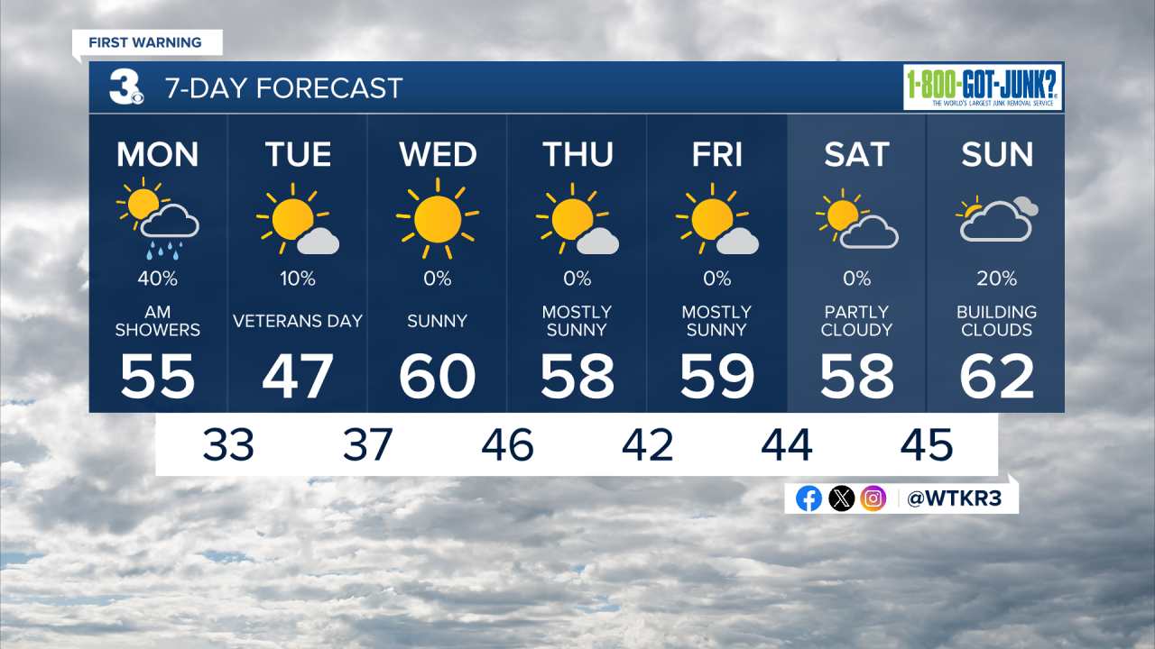
This morning will start out cloudy with showers possible. Temperatures will start in the low to mid 50s and remain the same for most of the day, with high temperatures in the mid 50s. Morning clouds and showers will give way to some sunshine during the afternoon. Winds will be out of the WNW at 10-15 mph. Overnight temperatures will plummet into the upper 20s to low 30s, with mid 30s along the immediate shoreline. A Freeze Warning is in effect through tomorrow morning for most of the region, make sure to bring sensitive plants inside. Some wet snow showers (yes, snow!) and flurries are possible late tonight, no accumulation is expected.


Veterans Day will be cold and windy, with winter-like temperatures in the mid 40s to around 50 degrees for high temperatures. We'll see mostly sunny skies along with windy conditions out of the WNW at 15-20 mph, gusting up to 30 mph at times. Overnight temperatures will drop back down into the 30s, frost will be possible once again. On Wednesday we'll see sunny skies and closer to normal temperatures in the upper 50s and low 60s. Winds will still be gusty, out of the SW at 10-20 mph. High pressure will take over to our south on Wednesday, keeping dry conditions in place for much of the week.

Thursday will be a step cooler than Wednesday, with highs in the mid to upper 50s. Temperatures will stay slightly below normal into the weekend, with dry conditions expected. Our next rainmaker looks to arrive Sunday night into Monday of next week.
Weather updates on social media:
