

Meteorologist Tony Nargi's First Warning Forecast
Today will start off cool in the 20s and low 30s, quickly jumping into the 40s by mid morning with afternoon high temperatures near normal in the 50s. Winds will be light, out of the SW at 5-10 mph. We'll see partly cloudy skies in the morning give way to mainly sunny skies during the afternoon. Overnight temperatures will fall into the mid to upper 30s.

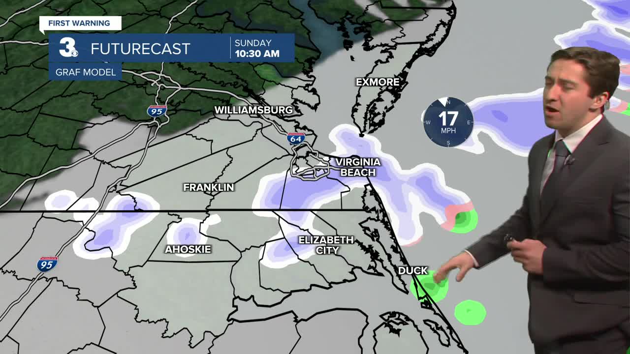
Tomorrow morning temperatures will start in the upper 30s to near 40. A cold front will move through the area throughout the morning, bringing scattered snow showers and dropping temperatures. Snow showers will result in a trace to an inch of snow accumulation for most. By the afternoon temperatures will be in the low 30s, with winds out of the NW at 10-20 mph, gusting up to 30 mph. Overnight temperatures will drop into the low 20s, with winds chills reaching as low as the single digits for some. Monday will be very cold, with highs in the low to mid 30s. We'll see mostly sunny skies and calming winds, starting out of the N at 10-15 mph and dropping to 5-10 mph by the afternoon.


Tuesday will begin a slow warm up for Hampton Roads as temperatures slowly climb into the 60s by the end of the week. Our next chance of precipitation looks to be in the form of some showers on Friday.

Weather updates on social media:
