Meteorologist Maddie Kirker's First Warning Forecast:
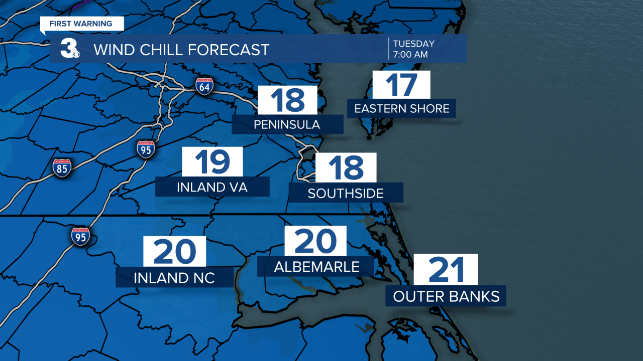
Feeling like winter in a big way when you wake up! Thanks to a cold Canadian air mass and mainly clear skies, temperatures will plummet to the 20s. And with a north wind between 10 and 15 mph, wind chills will be in the teens as we start our Tuesday.
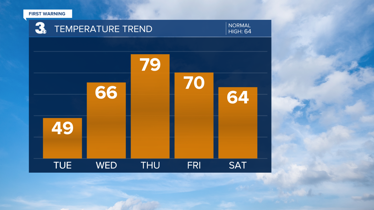
Despite the mainly sunny skies we'll get tomorrow afternoon, highs will only rebound to the upper 40s, which is 15 degrees below normal for this time of year. Tuesday should be dry with only a light shower possible on the Eastern Shore. Temperatures will rebound nicely by Wednesday and only trend warmer as we head into Thursday. Thursday will be the warmest day of the week and temperatures could touch the 80 degree mark before it's all said and done. It'd be nice if we were 80 and dry... but it isn't looking that way.
A rather strong cold front (similar to last weeks) is set to make it's way across the country over the next few days. Impacting locations such as Texas, then Mississippi, and then us. Here's a look at where that cold front could be by Thursday evening.
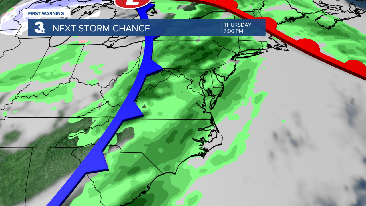
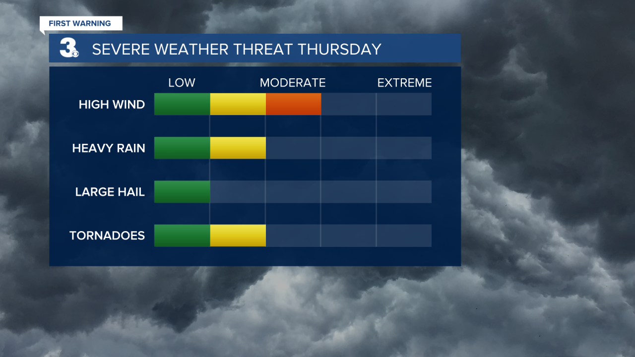
This cold front will give us our next chance of rain and it could also give us our next threat of severe weather. Based on the current dynamics, our area is already under a close eye for the threat of strong to severe storms Thursday night through early Friday morning. Below is the 4 day severe weather outlook put out from the Storm Prediction Center. This is where we've already got a 15% chance of Severe Weather between 8 am Thursday and 8 am Friday.

It's not so easy to predict the exact timing or type of severe weather we'll see this far out, however if we were to pinpoint the highest threats, damaging winds would be top of the list. Followed by heavy downpours and even tornadoes. A lot of the kind of forecasting we do this far out has less to do with the actual long range models and more with climatology and how these type of setups typically pan out for us. Of course, we'll have a better visual tomorrow - severe weather forecasting gets even better within the 3 day window as apposed to 4.