

Meteorologist Tony Nargi's First Warning Forecast
Tonight, we'll see some light showers and cloudy skies with temperatures dropping into the 60s and low 70s. Most of the shower activity will stay to our south and west, with the Outer Banks seeing the steadiest stream of showers. Winds will be out of the NE at 10-15 mph.

Tomorrow winds will pick up along with more cloudy skies and spotty (30% chance) showers. Highs will reach the mid 70s, with winds out of the NE at 10-20 mph, gusting up to 25 mph. Dew points will stay in the upper 60s to low 70s, keeping that humid feel in the air. Dangerous surf is expected at our beaches, with 6-9 feet of surf expected, along with 7-9 foot waves over the open waters of the Atlantic for boaters.

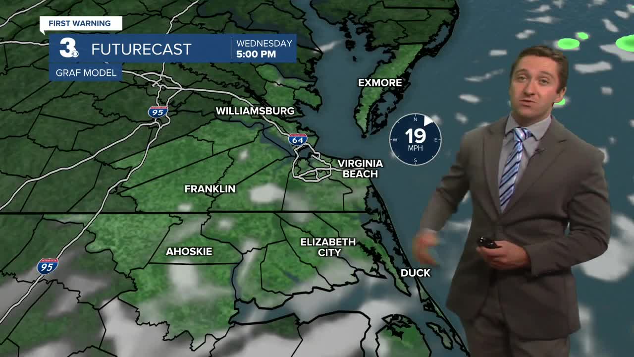
Wednesday we'll start to clear out but our winds will pick up as well. We'll see partly cloudy skies along with winds out of the NE at 15-25 mph, with gusts up to 35 mph possible. Gusts to 45 mph will be possible on the Outer Banks. High temperatures will be cool in the low 70s. Strong onshore winds will lead to nuisance to minor tidal flooding Wednesday afternoon, and a coastal flood warning will be in effect on the Outer Banks from Rodanthe on south until Friday.Dew points will drop down into the upper 50s and low 60s, bringing back some comfort to the air. On Thursday it'll be cool, but our winds will start to calm down. It'll be partly cloudy with highs in the upper 60s, along with winds out of the ENE at 10-20 mph, falling to 10-15 mph by the end of the day.


Friday into the weekend it will start to warm back up, with the high temperature jumping back to 80 by Monday. Winds will be much lighter Friday into the weekend as well, with mostly sunny skies expected.

TRACKING THE TROPICS
Hurricane Humberto is a major category 4 hurricane and will continue to head north well offshore. It will churn up a lot of life-threatening surf, with wave heights of 8-12 feet possible offshore on Wednesday. Hurricane Humberto will help influence Tropical Storm Imelda's (soon to be Hurricane) track, keeping it offshore.

Tropical Storm Imelda has been strengthening today and will continue to strengthen into a category 1 hurricane. Imelda will move east tomorrow through the weekend, churning up surf but keeping most of its rain well offshore. Last week's forecast had Imelda making landfall in South Carolina, but thankfully this forecast has changed dramatically since Friday and is now expected to have very minimal impacts.

Weather updates on social media:
