

Meteorologist Maddie Kirker's First Warning Forecast:
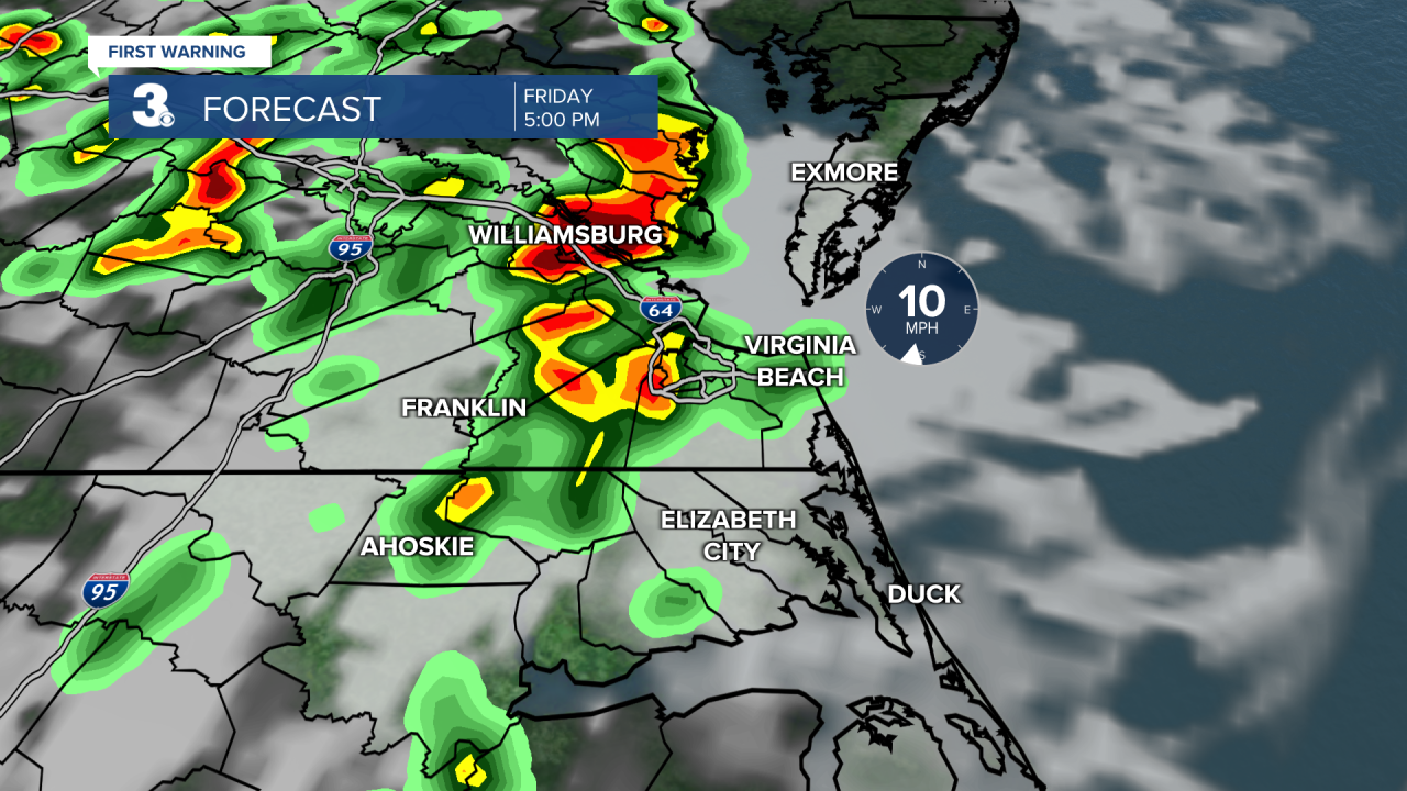
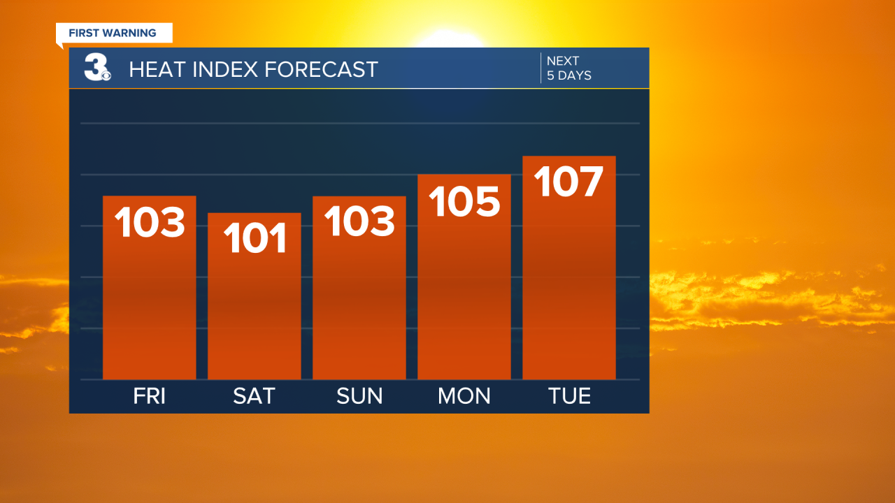
It looks like we'll be dry through lunchtime today. It'll be hot with highs in the low 90s with heat index values near 100. Once the heating of the day sets in, expect scattered showers and storms to develop this afternoon through this evening. Our atmosphere is very saturated today so any storm that forms will tap into that moisture and lead to periods of heavy rain. Today's heavy rain could lead to localized flooding and ponding on our area roadways. Storms that form in our northwestern locations including the Peninsulas and Eastern Shore could be strong to severe with strong winds. This is where we have a Level 1 Storm Threat.


Highs will linger in the low to mid 90s this weekend with an afternoon heat index near 100. We will see mostly sunny to partly cloudy skies with a scattered shower or storm possible, mainly in the afternoons to evenings.
A cold front is set to move through the region by midweek. This front will bring us a bigger chance for rain but should also usher in cooler air for the end of next week.
