

Meteorologist Tony Nargi's First Warning Forecast
Today will be great, with mostly sunny skies expected along with high temperatures in the mid 80s to near 90. We'll see a bit of a breeze out of the S at 10-15 mph, with 2 to 4 foot waves over the water. Temperatures will stay mild tonight, with low temps only dropping into the 60s.


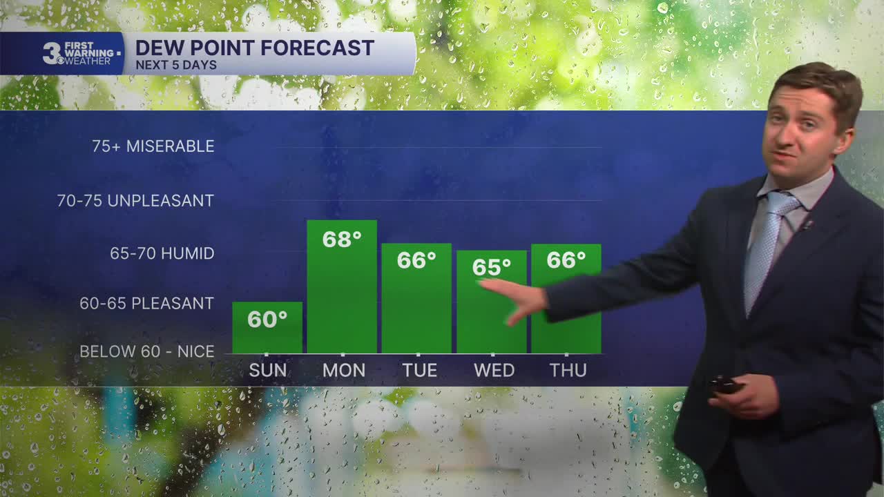
Tomorrow will be even warmer, with high temperatures in the upper 80s to low 90. We'll see plenty of sunshine, with just a few afternoon clouds possible. A stray shower or thunderstorm is possible around sunset, but most of the area will remain dry. Winds will be out of the S at 5-15 mph. Overnight will be mostly clear with low temperatures around 70. Monday will be another warm one, with high temperatures in the low 90s. Dew points will jump into the upper 60s on Monday afternoon, so the heat index will be in the mid to upper 90s! We'll see plenty of sunshine Monday as dry weather persists into next week.


Hot and dry conditions will continue into Tuesday and Wednesday, with summer-like temperatures in the low 90s and mostly sunny skies. Our next chance of rain and break in the hot and dry pattern comes on Thursday, with showers and thunderstorms likely along with cooler air moving in. By Friday of next week, temperatures will drop back down to near 70.

Weather updates on social media:
