

Meteorologist Tony Nargi's First Warning Forecast
Today will be hot and humid with high temperatures in the mid to upper 80s and heat indices (feels like) temperatures in the low to mid 90s. Winds will be out of the S at 5-10 mph. There's a 20% chance of a stray thunderstorm this afternoon, but conditions will be mainly dry with a summer like feel. Overnight temperature don't drop a whole lot, with lows in the 60s to low 70s. Some patchy fog is possible again tomorrow morning.

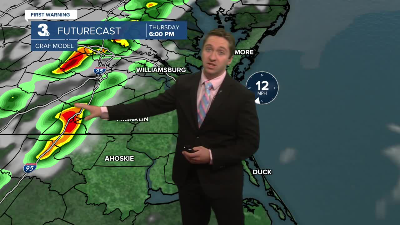
Tomorrow will be hot and humid as well, with highs in the mid 80s to 90 with heat indices in the mid to upper 90s. We'll see partly cloudy skies throughout the day, with an increasing chance of thunderstorms in the late afternoon through the evening. We have a marginal (1/5) risk of severe weather Thursday evening, with the main threat being strong wind gusts from organized storms. The timing of those storms would be 6 pm to midnight. Friday will be mainly cloudy with non-severe thunderstorms and showers, with highs dropping into the low 80s.


This weekend will be a bit dreary, with lingering showers as a cold front stalls offshore with highs in the upper 70s to low 80s. Monday into Tuesday we're keeping an eye out for impacts from potential tropical cyclones, though that forecast is still very uncertain.

TROPICS
Hurricane Gabrielle is a Category 3 Hurricane and moving towards the Azores, and will continue to weaken as it approaches the islands.

Two areas of development are now likely over the next week, with invest 93L (east) likely to develop today or tomorrow and invest 94L (west) posing the biggest threat to us here. Both of these areas of development have the potential to develop into tropical storms and even hurricanes, but right now the most favorable area to become a strong tropical cyclone would be 93L. 93L would be more likely to stay offshore, whereas 94L have a higher chance of bringing us impacts here, with gusty winds, heavy rain, and tidal flooding being the impacts. With two cyclones so close together, models are struggling to figure out how they will interact with each other, along with a third low pressure system that will be over the SE US later this week. We'll keep you updated as confidence increases.

Weather updates on social media:
