


Meteorologist Maddie Kirker's First Warning Forecast:
Expect partly cloudy skies overnight with a stray shower or storm possible. It'll be muggy with lows in the mid 70s.

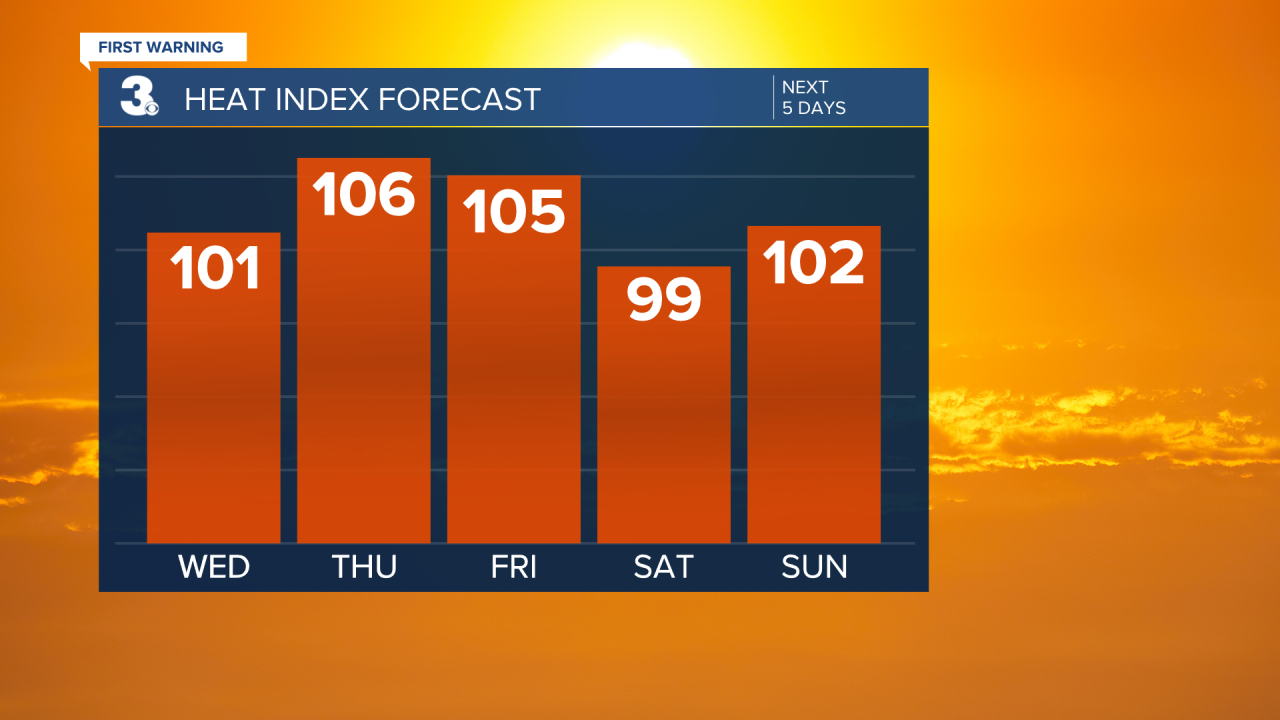
More summertime heat is expected this week. Highs will reach the low 90s Wednedsday but get even higher Thursday and Friday. And that's not all - factor in the dew points and heat index values will be in the triple digits and near the Heat Advisory threshold Thursday. We will see a mix of mostly sunny to partly cloudy skies this week with an isolated shower or storm possible each day (20% to 30% chance).

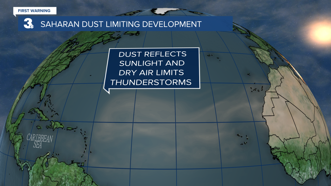
It's been exactly one month since our last Tropical Storm (Colin formed right off the coast of South Carolina July 2nd only to dissipate less than a day later near the Outer Banks.) While it may seem quiet out there, historically speaking this is usually the case this time of year. Why? Well, we currently have the dry Saharan Dust drifting out over the open Atlantic choking any hopes for moisture and tropical systems. And this dry plume is expected over the next 5 to 7 days.
We're 33% through the 2022 Hurricane Season. As you can see we still have plenty of time left for the "dust to settle" and the tropics to heat up through October. As always, we'll update you right here if/when that happens!

