


Meteorologist Myles Henderson’s First Warning Forecast
More heat and humidity through midweek. Tracking a cold front that will bring us bigger rain chances but also a cool down for the end of the week.
We will warm to the mid 90s today with an afternoon heat index near 105. Expect a nice mix of sun and clouds today with slim rain chances. It will be breezy today with SW winds at 10 to 15 mph.
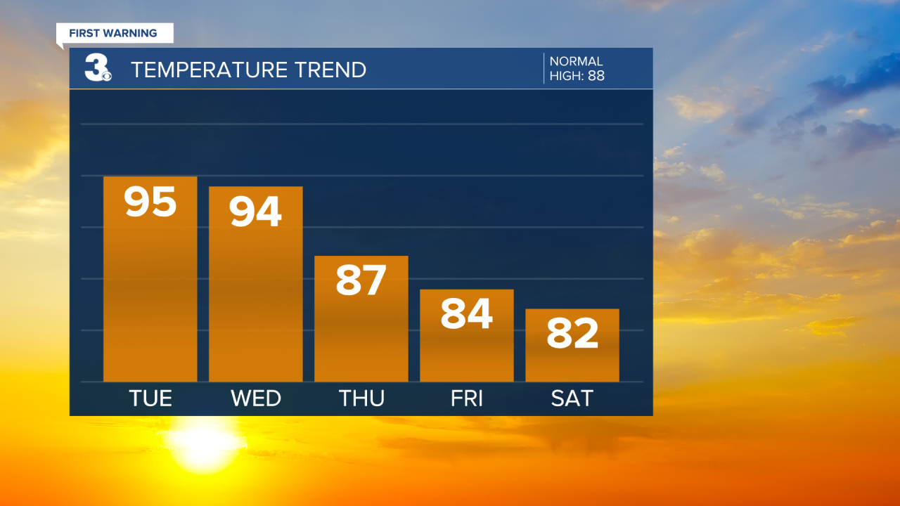
Get ready for another hot day tomorrow! Highs will return to the mid 90s with an afternoon heat index to 105+. We will start with sunshine Wednesday morning, but clouds will build through the afternoon. Scattered showers and storms will move in tomorrow afternoon to evening as a cold front approaches.

Expect partly to mostly cloudy skies on Thursday with scattered showers and storms. Highs will drop to the mid and upper 80s, but it will still be humid.
Cooler and less humid air will move in behind the cold front. Highs will drop to the mid 80s on Friday with falling humidity through the day. This weekend looks great! We will see mostly sunny skies with highs in the low to mid 80s and lower humidity.
Today: A Few Clouds. Highs in the mid 90s. Winds: SW 10-15
Tonight: A Few Clouds. Lows in the mid 70s. Winds: SW 5-10
Tomorrow: AM Sun, PM Storms. Highs in the mid 90s. Winds: SW 5-15
Weather & Health
Pollen: Medium (Grasses)
UV Index: 9 (Very High)
Air Quality: Good (Code Green)
Mosquitoes: Extreme
Tropical Update
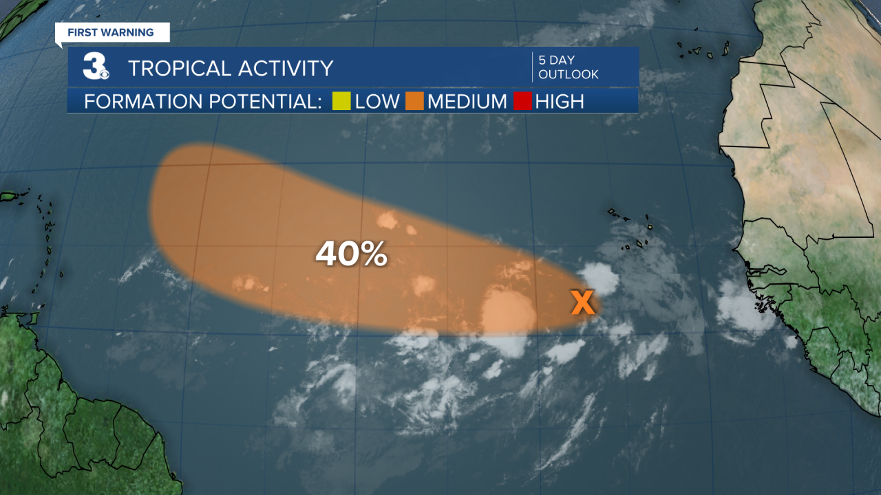
A tropical wave continues to produce a large area of disorganized cloudiness and thunderstorms over the eastern tropical Atlantic a few hundred miles SSW of the Cabo Verde Islands. Gradual development of this system is possible, and a tropical depression could form around the middle to latter portion of the week before environmental conditions become less favorable by this weekend. This system is expected to move west to WNW at 15 to 20 mph across the tropical Atlantic during the next several days.
* Formation chance through 48 hours: Low (20%)
* Formation chance through 5 days: Medium (40%)
Weather updates on social media:
Facebook: MylesHendersonWTKR
Twitter: @MHendersonWTKR
Instagram: @MylesHendersonWTKR
