

Chief Meteorologist Patrick Rockey's First Warning Forecast:
Today was our third day of 90° weather on this, the hottest week of the year so far. And it looks like it’s going to get significantly hotter and more humid.
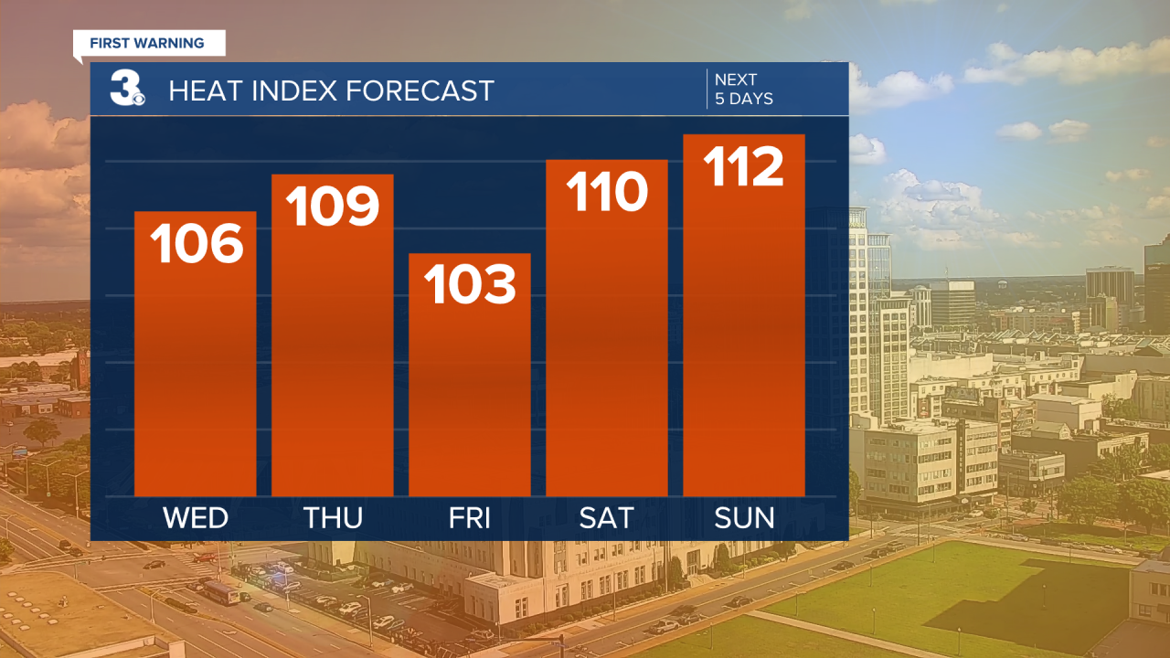
We will climb several degrees on Wednesday topping out in the mid 90s in the afternoon with feels-like temperatures around 106°!
A stray storm may pop up in the afternoon and evening, but most of us will stay dry.
Our storm chances go up quite a bit on Thursday along with our temperatures.
A gusty southwest wind ahead of a cold front will pump in the heat and humidity.
The thermometer will climb into the mid-to-upper 90s with heat index values approaching 110°!

However late in the afternoon and into the evening hours expect a line of strong storms to roll in along with that cold front. A few of the storms could be severe, producing gusty winds and heavy downpours.
You know this is a summer cold front when our temperatures only drop 4° to around 93° on Friday. But we will take whatever relief we can get!
Our hottest temperatures arrive this weekend. If we do hit the 100° mark over the next week, it will likely be Saturday or Sunday.

We are forecasting high temperatures in the upper 90s both days with heat index values between 110 and 112.
Rain chances go up as we head into the workweek and temperatures go down, at least a few degrees. But we will welcome any relief.
