Meteorologist Maddie Kirker's First Warning Forecast:
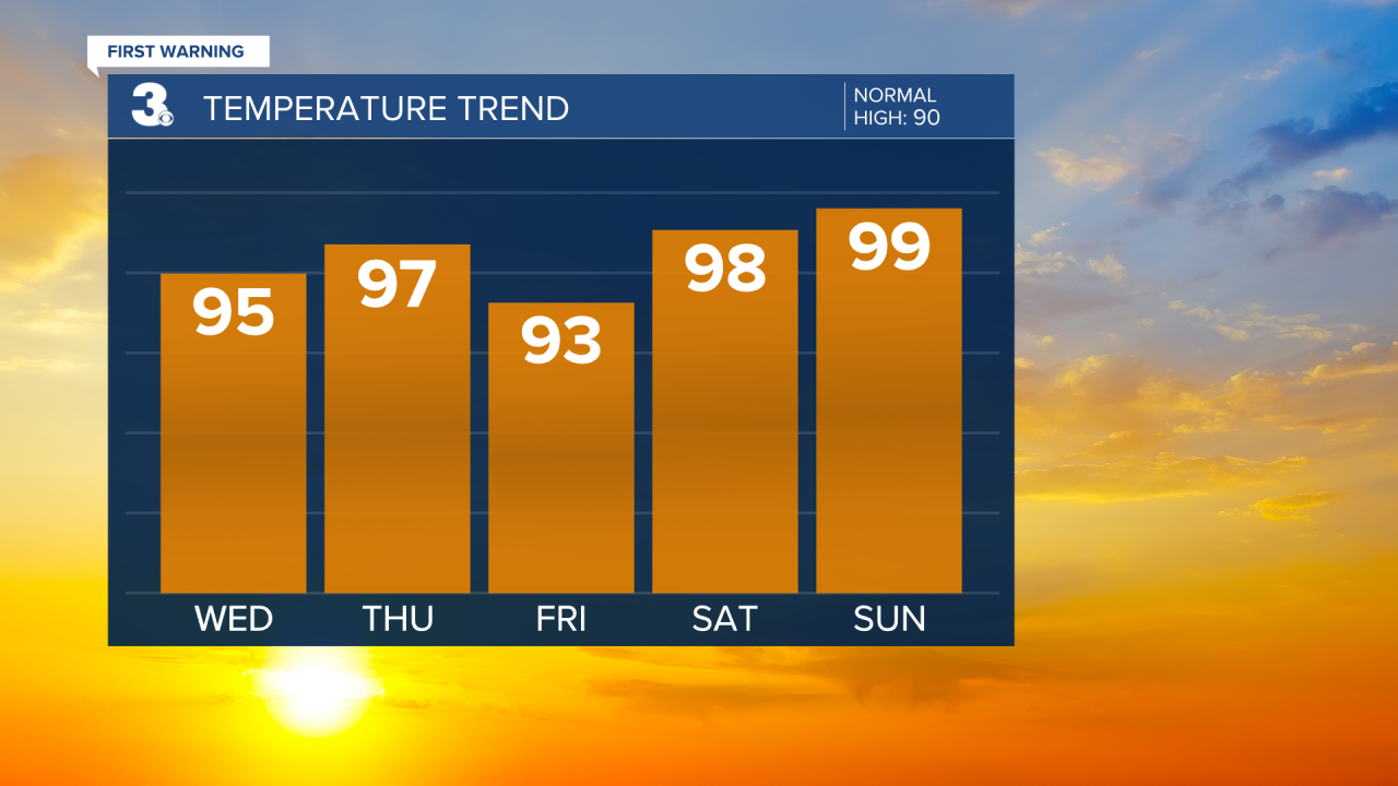
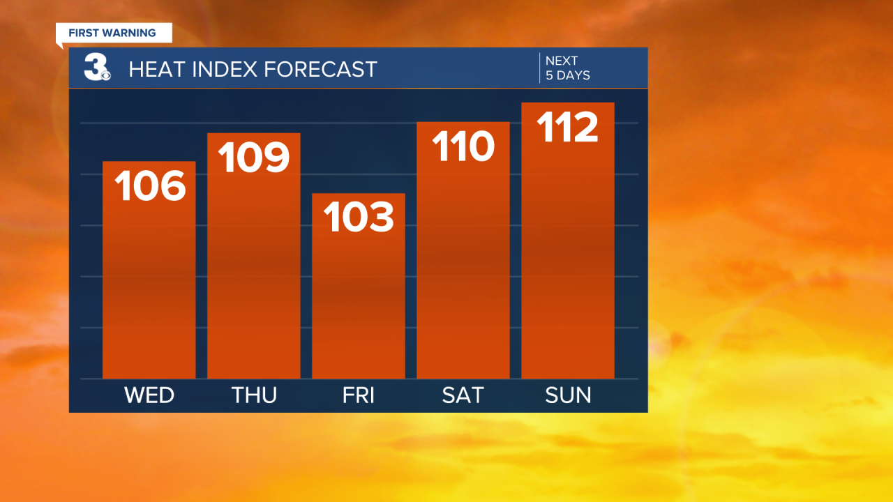
Dangerously hot and humid… We're starting this Wednesday warm and humid with temperatures in the 70s. Highs will soar to the mid 90s today, with heat index values between 100 and 105 degrees.
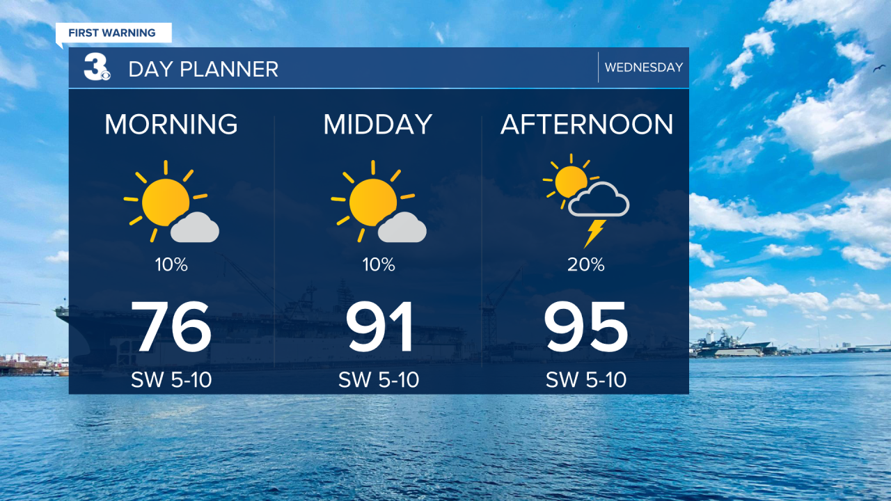
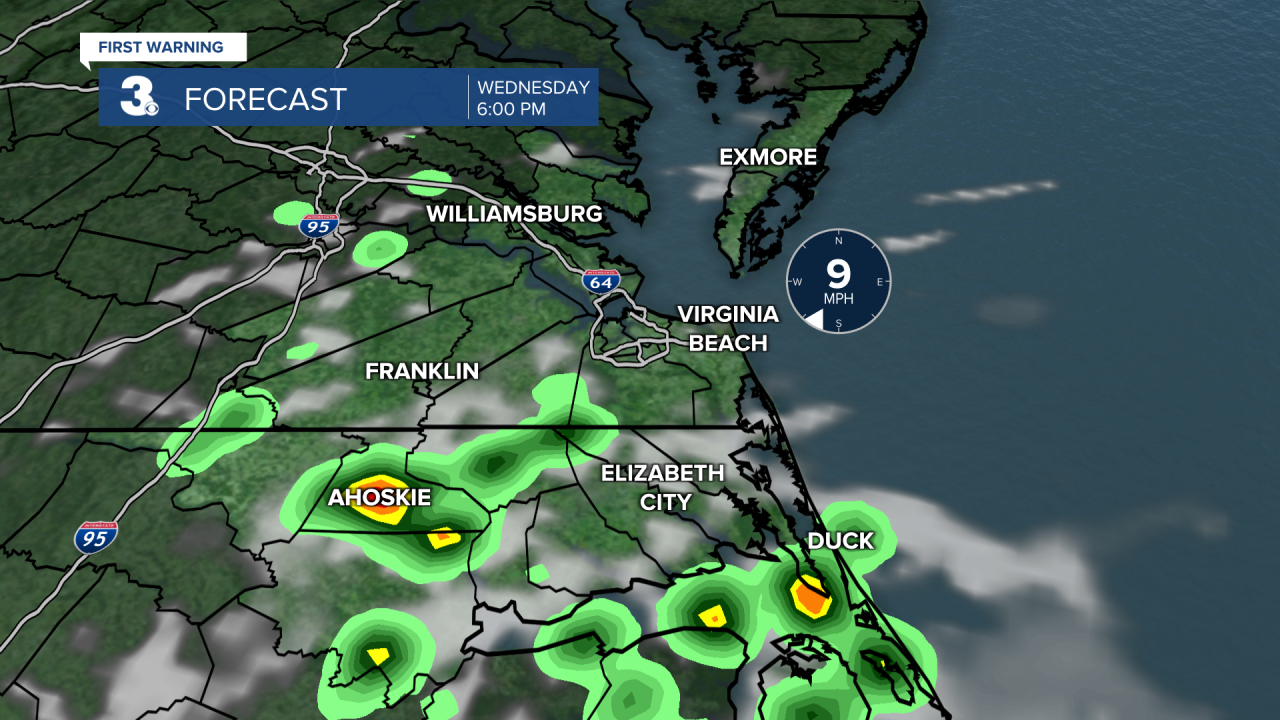
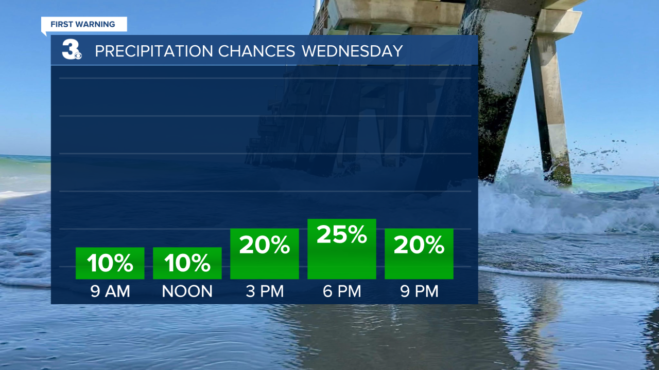
It'll be mainly sunny to start, with building clouds and a few showers and storms late this afternoon to early evening, especially across North Carolina. Any storm that forms could produce brief heavy rain, but severe storms are not expected.
Tonight, will be very warm with lows in near 80.
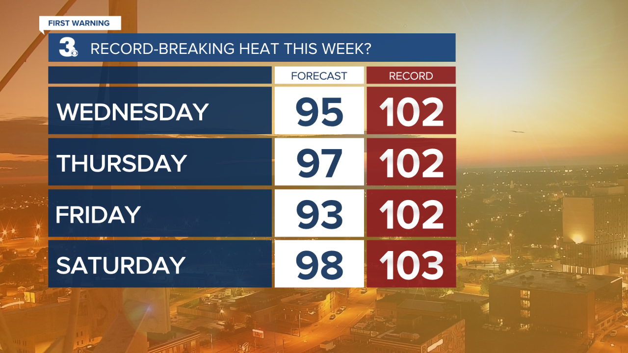
We're cranking up the dial even more Thursday. Highs will soar to the upper 90s with heat index values near 110. This will be the hottest day of the work week, but a dying cold front moving in from northwest to southeast could cool us down with scattered showers and storms late.
The entire area is under a Level 1 Storm threat Thursday as some storms could be strong to severe with heavy downpours and gusty winds the primary threats.

We'll "cool" to the low 90s Friday but soar again to the upper 90s Saturday and Sunday. Parts of the area could actually touch the 100s. Heat index values this weekend will be near 110. Both Friday, Saturday and Sunday look mainly dry, with only the potential of a pop-up shower or storm.